H48A Harrisville, MI, USA - Earthquake Result Viewer
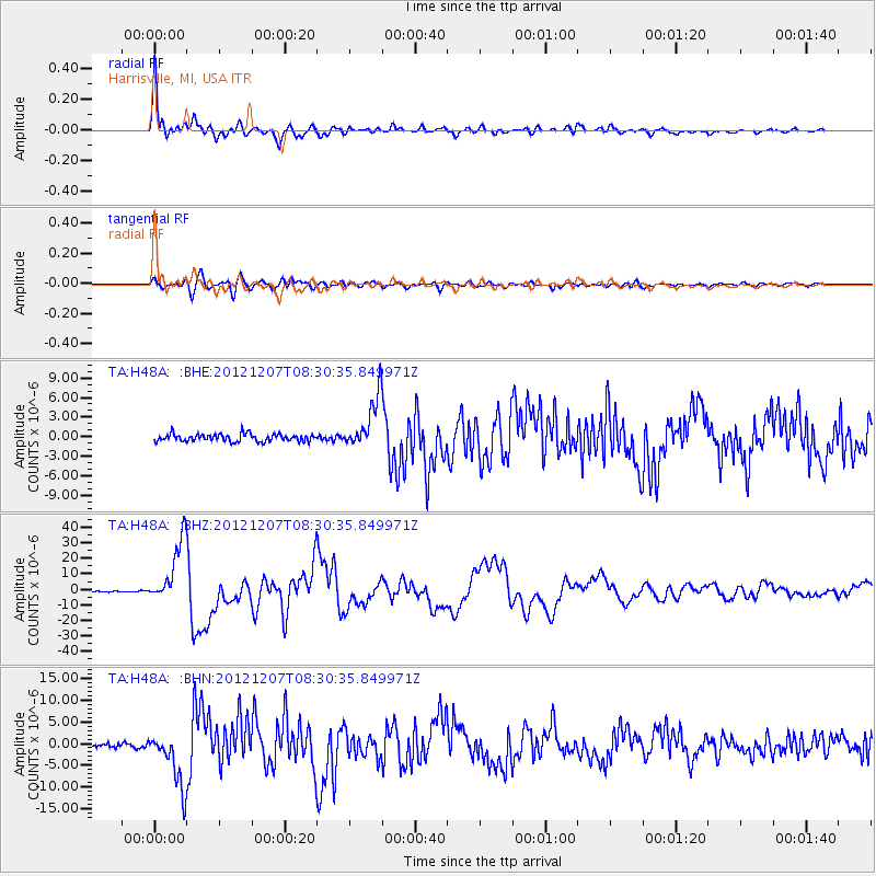
Earthquake location: Off East Coast Of Honshu, Japan
Earthquake latitude/longitude: 37.9/143.9
Earthquake time(UTC): 2012/12/07 (342) 08:18:23 GMT
Earthquake Depth: 31 km
Earthquake Magnitude: 7.2 MB, 7.3 MS, 7.3 MW, 7.3 MW
Earthquake Catalog/Contributor: WHDF/NEIC
Network: TA USArray Transportable Network (new EarthScope stations)
Station: H48A Harrisville, MI, USA
Lat/Lon: 44.70 N/83.32 W
Elevation: 244 m
Distance: 87.4 deg
Az: 31.63 deg
Baz: 324.421 deg
Ray Param: 0.04333644
Estimated Moho Depth: 39.75 km
Estimated Crust Vp/Vs: 1.60
Assumed Crust Vp: 6.483 km/s
Estimated Crust Vs: 4.052 km/s
Estimated Crust Poisson's Ratio: 0.18
Radial Match: 97.14046 %
Radial Bump: 400
Transverse Match: 88.20669 %
Transverse Bump: 400
SOD ConfigId: 488671
Insert Time: 2013-03-29 04:55:37.243 +0000
GWidth: 2.5
Max Bumps: 400
Tol: 0.001

Signal To Noise

ChannelStoNSTALTA
TA:H48A: :BHZ:20121207T08:30:35.849971Z34.644582.0526897E-55.924995E-7
TA:H48A: :BHN:20121207T08:30:35.849971Z13.3034676.380856E-64.796386E-7
TA:H48A: :BHE:20121207T08:30:35.849971Z6.8763133.973322E-65.7782734E-7
Arrivals
Ps3.8 SECOND
PpPs16 SECOND
PsPs/PpSs19 SECOND