
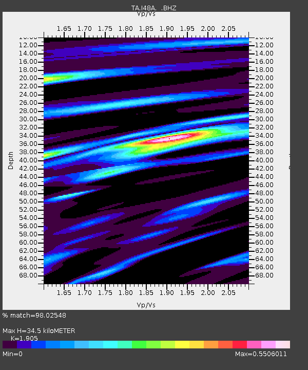
I48A Sherman Twp, MI, USA - Earthquake Result Viewer
| ||||||||||||||||||
| ||||||||||||||||||
| ||||||||||||||||||
|
Signal To Noise
| Channel | StoN | STA | LTA |
| TA:I48A: :BHZ:20121207T08:30:37.075007Z | 51.52816 | 1.9663696E-5 | 3.8161065E-7 |
| TA:I48A: :BHN:20121207T08:30:37.075007Z | 11.164331 | 5.0763256E-6 | 4.5469142E-7 |
| TA:I48A: :BHE:20121207T08:30:37.075007Z | 8.361891 | 3.361901E-6 | 4.0205035E-7 |
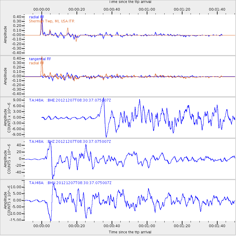
| Arrivals | |
| Ps | 4.9 SECOND |
| PpPs | 15 SECOND |
| PsPs/PpSs | 20 SECOND |

