H46A Fife Lake, MI, USA - Earthquake Result Viewer
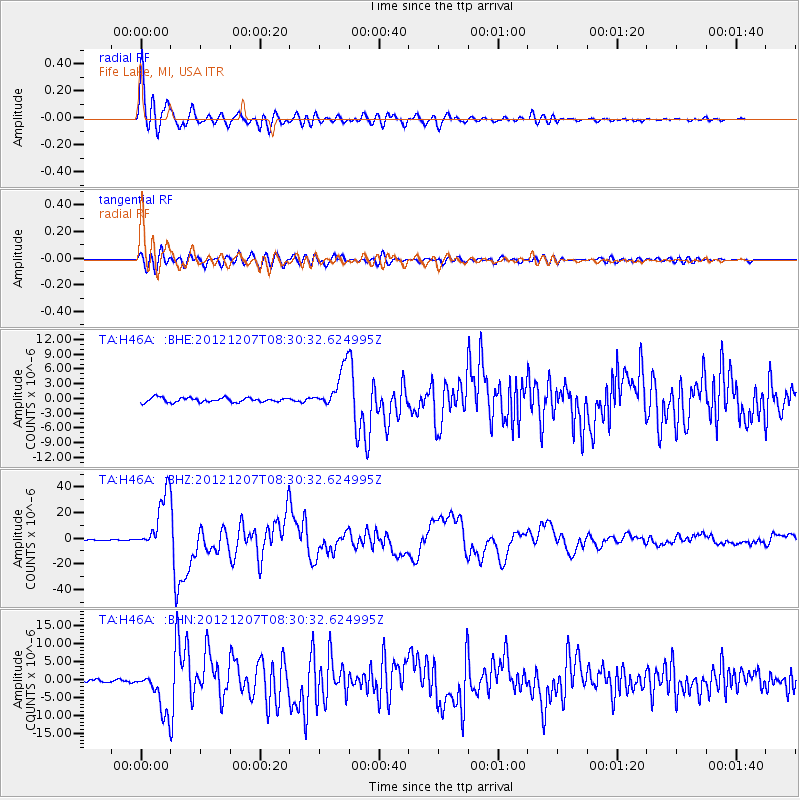
Earthquake location: Off East Coast Of Honshu, Japan
Earthquake latitude/longitude: 37.9/143.9
Earthquake time(UTC): 2012/12/07 (342) 08:18:23 GMT
Earthquake Depth: 31 km
Earthquake Magnitude: 7.2 MB, 7.3 MS, 7.3 MW, 7.3 MW
Earthquake Catalog/Contributor: WHDF/NEIC
Network: TA USArray Transportable Network (new EarthScope stations)
Station: H46A Fife Lake, MI, USA
Lat/Lon: 44.54 N/85.20 W
Elevation: 329 m
Distance: 86.7 deg
Az: 32.809 deg
Baz: 323.167 deg
Ray Param: 0.043816924
Estimated Moho Depth: 22.5 km
Estimated Crust Vp/Vs: 1.60
Assumed Crust Vp: 6.483 km/s
Estimated Crust Vs: 4.052 km/s
Estimated Crust Poisson's Ratio: 0.18
Radial Match: 97.33963 %
Radial Bump: 400
Transverse Match: 82.64705 %
Transverse Bump: 400
SOD ConfigId: 488671
Insert Time: 2013-03-29 04:55:53.048 +0000
GWidth: 2.5
Max Bumps: 400
Tol: 0.001

Signal To Noise

ChannelStoNSTALTA
TA:H46A: :BHZ:20121207T08:30:32.624995Z47.4666372.2168042E-54.6702365E-7
TA:H46A: :BHN:20121207T08:30:32.624995Z14.1072165.859748E-64.1537237E-7
TA:H46A: :BHE:20121207T08:30:32.624995Z9.0792734.23924E-64.66914E-7
Arrivals
Ps2.1 SECOND
PpPs8.8 SECOND
PsPs/PpSs11 SECOND