H56A Elgin, ON, CAN - Earthquake Result Viewer
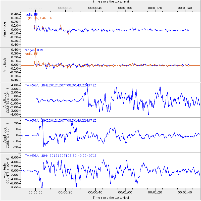
Earthquake location: Off East Coast Of Honshu, Japan
Earthquake latitude/longitude: 37.9/143.9
Earthquake time(UTC): 2012/12/07 (342) 08:18:23 GMT
Earthquake Depth: 31 km
Earthquake Magnitude: 7.2 MB, 7.3 MS, 7.3 MW, 7.3 MW
Earthquake Catalog/Contributor: WHDF/NEIC
Network: TA USArray Transportable Network (new EarthScope stations)
Station: H56A Elgin, ON, CAN
Lat/Lon: 44.59 N/76.26 W
Elevation: 137 m
Distance: 90.2 deg
Az: 27.467 deg
Baz: 329.285 deg
Ray Param: 0.041685484
Estimated Moho Depth: 39.25 km
Estimated Crust Vp/Vs: 1.85
Assumed Crust Vp: 6.577 km/s
Estimated Crust Vs: 3.555 km/s
Estimated Crust Poisson's Ratio: 0.29
Radial Match: 97.84121 %
Radial Bump: 352
Transverse Match: 93.07374 %
Transverse Bump: 400
SOD ConfigId: 488671
Insert Time: 2013-03-29 04:57:09.877 +0000
GWidth: 2.5
Max Bumps: 400
Tol: 0.001

Signal To Noise

ChannelStoNSTALTA
TA:H56A: :BHZ:20121207T08:30:49.224971Z42.705621.3606906E-53.1862098E-7
TA:H56A: :BHN:20121207T08:30:49.224971Z12.6768353.8135965E-63.0083194E-7
TA:H56A: :BHE:20121207T08:30:49.224971Z8.8162012.0282205E-62.3005606E-7
Arrivals
Ps5.2 SECOND
PpPs17 SECOND
PsPs/PpSs22 SECOND