
AHID Auburn Hatchery, Idaho, USA - Earthquake Result Viewer
| ||||||||||||||||||
| ||||||||||||||||||
| ||||||||||||||||||
|
Signal To Noise
| Channel | StoN | STA | LTA |
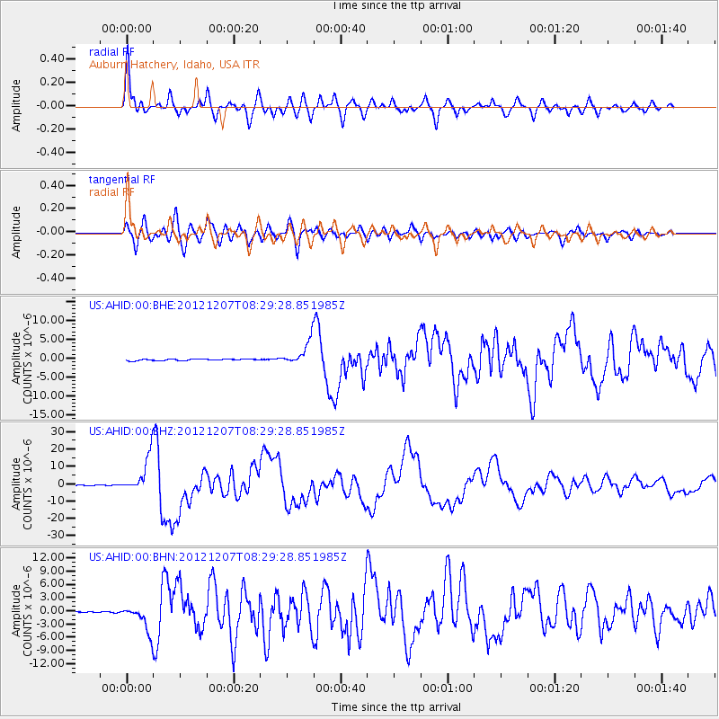
| US:AHID:00:BHZ:20121207T08:29:28.851985Z | 135.90802 | 1.110323E-5 | 8.169665E-8 |
| US:AHID:00:BHN:20121207T08:29:28.851985Z | 14.391548 | 3.1824786E-6 | 2.2113525E-7 |
| US:AHID:00:BHE:20121207T08:29:28.851985Z | 17.137117 | 3.336449E-6 | 1.9469138E-7 |
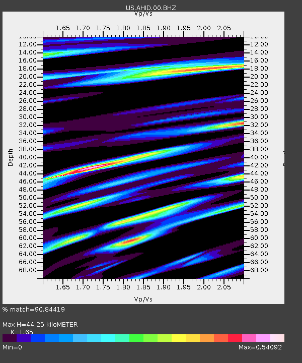
| Arrivals | |
| Ps | 4.8 SECOND |
| PpPs | 18 SECOND |
| PsPs/PpSs | 23 SECOND |

