
LEBA Lebam, WA, USA - Earthquake Result Viewer
| ||||||||||||||||||
| ||||||||||||||||||
| ||||||||||||||||||
|
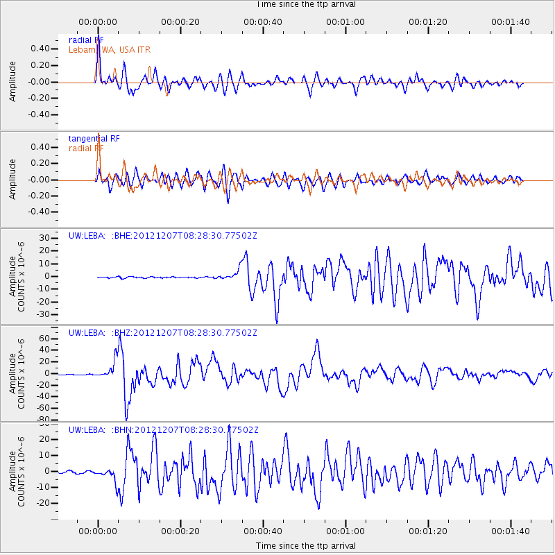
Signal To Noise
| Channel | StoN | STA | LTA |
| UW:LEBA: :BHZ:20121207T08:28:30.77502Z | 41.946793 | 1.632919E-5 | 3.8928343E-7 |
| UW:LEBA: :BHN:20121207T08:28:30.77502Z | 9.934002 | 4.3893497E-6 | 4.418511E-7 |
| UW:LEBA: :BHE:20121207T08:28:30.77502Z | 9.485773 | 4.419021E-6 | 4.6585777E-7 |
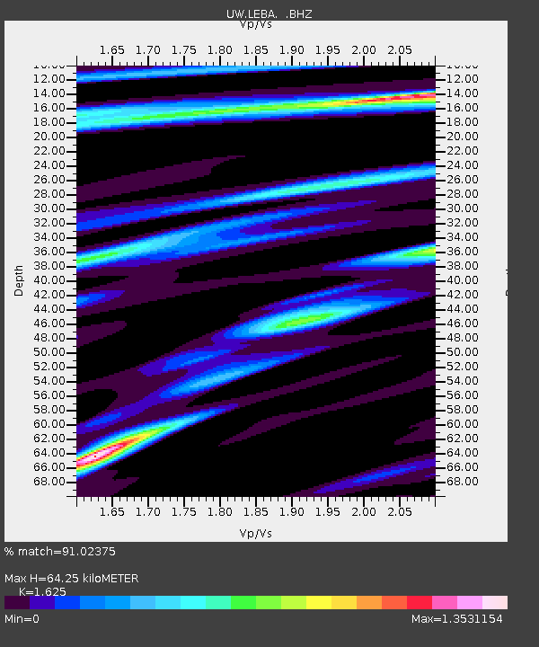
| Arrivals | |
| Ps | 6.4 SECOND |
| PpPs | 24 SECOND |
| PsPs/PpSs | 31 SECOND |

