PASS Maple Falls, WA, USA - Earthquake Result Viewer
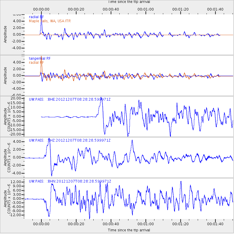
Earthquake location: Off East Coast Of Honshu, Japan
Earthquake latitude/longitude: 37.9/143.9
Earthquake time(UTC): 2012/12/07 (342) 08:18:23 GMT
Earthquake Depth: 31 km
Earthquake Magnitude: 7.2 MB, 7.3 MS, 7.3 MW, 7.3 MW
Earthquake Catalog/Contributor: WHDF/NEIC
Network: UW Pacific Northwest Regional Seismic Network
Station: PASS Maple Falls, WA, USA
Lat/Lon: 49.00 N/122.09 W
Elevation: 174 m
Distance: 64.9 deg
Az: 46.512 deg
Baz: 299.357 deg
Ray Param: 0.058575816
Estimated Moho Depth: 11.0 km
Estimated Crust Vp/Vs: 1.65
Assumed Crust Vp: 6.566 km/s
Estimated Crust Vs: 3.98 km/s
Estimated Crust Poisson's Ratio: 0.21
Radial Match: 91.35828 %
Radial Bump: 400
Transverse Match: 78.72828 %
Transverse Bump: 400
SOD ConfigId: 488671
Insert Time: 2013-03-29 04:59:36.296 +0000
GWidth: 2.5
Max Bumps: 400
Tol: 0.001

Signal To Noise

ChannelStoNSTALTA
UW:PASS: :BHZ:20121207T08:28:28.599971Z9.8702672.129993E-62.157989E-7
UW:PASS: :BHN:20121207T08:28:28.599971Z21.29835.7362827E-62.6933054E-7
UW:PASS: :BHE:20121207T08:28:28.599971Z29.6375929.511091E-63.2091307E-7
Arrivals
Ps1.1 SECOND
PpPs4.2 SECOND
PsPs/PpSs5.4 SECOND