You are here: Home > Network List > TA - USArray Transportable Network (new EarthScope stations) Stations List
> Station C06D Leavenworth, WQ, USA > Earthquake Result Viewer
C06D Leavenworth, WQ, USA - Earthquake Result Viewer
*The percent match for this event was below the threshold and hence no stack was calculated.
| Earthquake location: |
Off East Coast Of Honshu, Japan |
| Earthquake latitude/longitude: |
37.9/143.8 |
| Earthquake time(UTC): |
2012/12/07 (342) 08:31:14 GMT |
| Earthquake Depth: |
32 km |
| Earthquake Magnitude: |
6.1 MB, 6.2 MW, 6.2 MW |
| Earthquake Catalog/Contributor: |
WHDF/NEIC |
|
| Network: |
TA USArray Transportable Network (new EarthScope stations) |
| Station: |
C06D Leavenworth, WQ, USA |
| Lat/Lon: |
47.92 N/120.89 W |
| Elevation: |
544 m |
|
| Distance: |
66.2 deg |
| Az: |
47.041 deg |
| Baz: |
300.618 deg |
| Ray Param: |
$rayparam |
*The percent match for this event was below the threshold and hence was not used in the summary stack. |
|
| Radial Match: |
71.48985 % |
| Radial Bump: |
400 |
| Transverse Match: |
69.181625 % |
| Transverse Bump: |
378 |
| SOD ConfigId: |
488671 |
| Insert Time: |
2013-03-29 05:08:38.883 +0000 |
| GWidth: |
2.5 |
| Max Bumps: |
400 |
| Tol: |
0.001 |
|
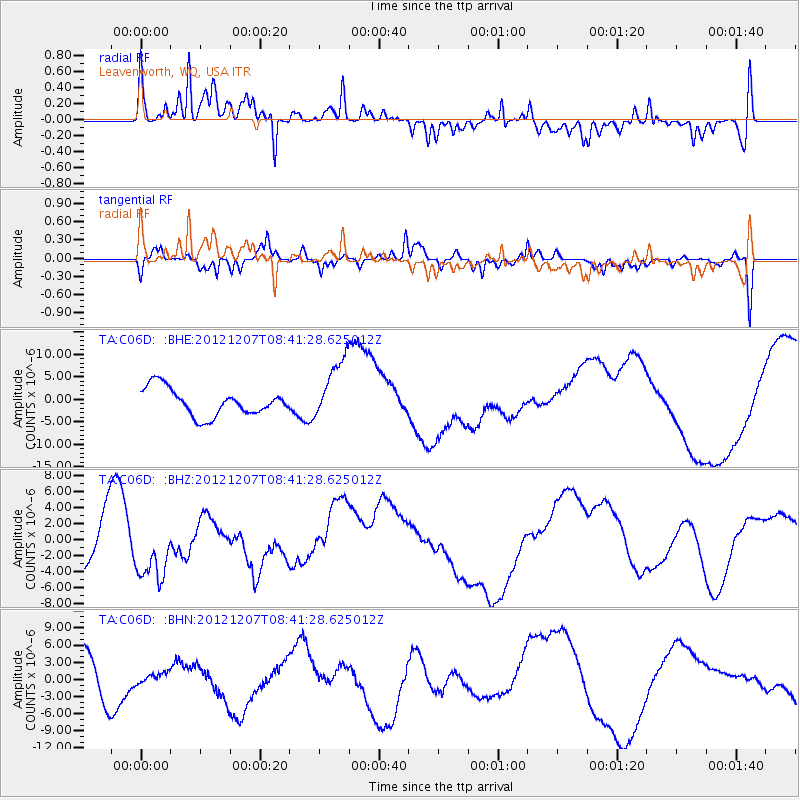
Signal To Noise
| Channel | StoN | STA | LTA |
| TA:C06D: :BHZ:20121207T08:41:28.625012Z | 1.7921978 | 3.9808433E-6 | 2.2212075E-6 |
| TA:C06D: :BHN:20121207T08:41:28.625012Z | 0.27403158 | 9.1726787E-7 | 3.3473075E-6 |
| TA:C06D: :BHE:20121207T08:41:28.625012Z | 2.337785 | 7.068828E-6 | 3.0237288E-6 |
| Arrivals |
| Ps | |
| PpPs | |
| PsPs/PpSs | |


