You are here: Home > Network List > TA - USArray Transportable Network (new EarthScope stations) Stations List
> Station 149A Jones, AL, USA > Earthquake Result Viewer
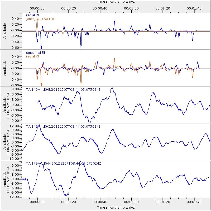
149A Jones, AL, USA - Earthquake Result Viewer
*The percent match for this event was below the threshold and hence no stack was calculated.
| Earthquake location: |
Off East Coast Of Honshu, Japan |
| Earthquake latitude/longitude: |
37.9/143.8 |
| Earthquake time(UTC): |
2012/12/07 (342) 08:31:14 GMT |
| Earthquake Depth: |
32 km |
| Earthquake Magnitude: |
6.1 MB, 6.2 MW, 6.2 MW |
| Earthquake Catalog/Contributor: |
WHDF/NEIC |
|
| Network: |
TA USArray Transportable Network (new EarthScope stations) |
| Station: |
149A Jones, AL, USA |
| Lat/Lon: |
32.60 N/86.79 W |
| Elevation: |
138 m |
|
| Distance: |
95.5 deg |
| Az: |
40.911 deg |
| Baz: |
322.148 deg |
| Ray Param: |
$rayparam |
*The percent match for this event was below the threshold and hence was not used in the summary stack. |
|
| Radial Match: |
70.985756 % |
| Radial Bump: |
256 |
| Transverse Match: |
62.255962 % |
| Transverse Bump: |
400 |
| SOD ConfigId: |
488671 |
| Insert Time: |
2013-03-29 05:11:03.282 +0000 |
| GWidth: |
2.5 |
| Max Bumps: |
400 |
| Tol: |
0.001 |
|
Signal To Noise
| Channel | StoN | STA | LTA |
| TA:149A: :BHZ:20121207T08:44:05.075024Z | 2.9297845 | 1.0667577E-5 | 3.6410793E-6 |
| TA:149A: :BHN:20121207T08:44:05.075024Z | 2.8954418 | 8.074566E-6 | 2.7887163E-6 |
| TA:149A: :BHE:20121207T08:44:05.075024Z | 2.9599237 | 7.949255E-6 | 2.685628E-6 |
| Arrivals |
| Ps | |
| PpPs | |
| PsPs/PpSs | |


