You are here: Home > Network List > TA - USArray Transportable Network (new EarthScope stations) Stations List
> Station Z51A Franklin, GA, USA > Earthquake Result Viewer
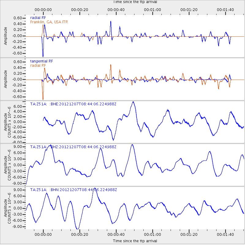
Z51A Franklin, GA, USA - Earthquake Result Viewer
*The percent match for this event was below the threshold and hence no stack was calculated.
| Earthquake location: |
Off East Coast Of Honshu, Japan |
| Earthquake latitude/longitude: |
37.9/143.8 |
| Earthquake time(UTC): |
2012/12/07 (342) 08:31:14 GMT |
| Earthquake Depth: |
32 km |
| Earthquake Magnitude: |
6.1 MB, 6.2 MW, 6.2 MW |
| Earthquake Catalog/Contributor: |
WHDF/NEIC |
|
| Network: |
TA USArray Transportable Network (new EarthScope stations) |
| Station: |
Z51A Franklin, GA, USA |
| Lat/Lon: |
33.32 N/85.17 W |
| Elevation: |
249 m |
|
| Distance: |
95.8 deg |
| Az: |
39.388 deg |
| Baz: |
323.173 deg |
| Ray Param: |
$rayparam |
*The percent match for this event was below the threshold and hence was not used in the summary stack. |
|
| Radial Match: |
58.483295 % |
| Radial Bump: |
400 |
| Transverse Match: |
65.98079 % |
| Transverse Bump: |
400 |
| SOD ConfigId: |
488671 |
| Insert Time: |
2013-03-29 05:12:42.316 +0000 |
| GWidth: |
2.5 |
| Max Bumps: |
400 |
| Tol: |
0.001 |
|
Signal To Noise
| Channel | StoN | STA | LTA |
| TA:Z51A: :BHZ:20121207T08:44:06.224988Z | 1.8280127 | 8.7609005E-6 | 4.792582E-6 |
| TA:Z51A: :BHN:20121207T08:44:06.224988Z | 2.0397236 | 4.5626202E-6 | 2.2368815E-6 |
| TA:Z51A: :BHE:20121207T08:44:06.224988Z | 1.5448583 | 3.2291236E-6 | 2.0902394E-6 |
| Arrivals |
| Ps | |
| PpPs | |
| PsPs/PpSs | |


