You are here: Home > Network List > UW - Pacific Northwest Regional Seismic Network Stations List
> Station MRBL Marblemount, WA, USA > Earthquake Result Viewer
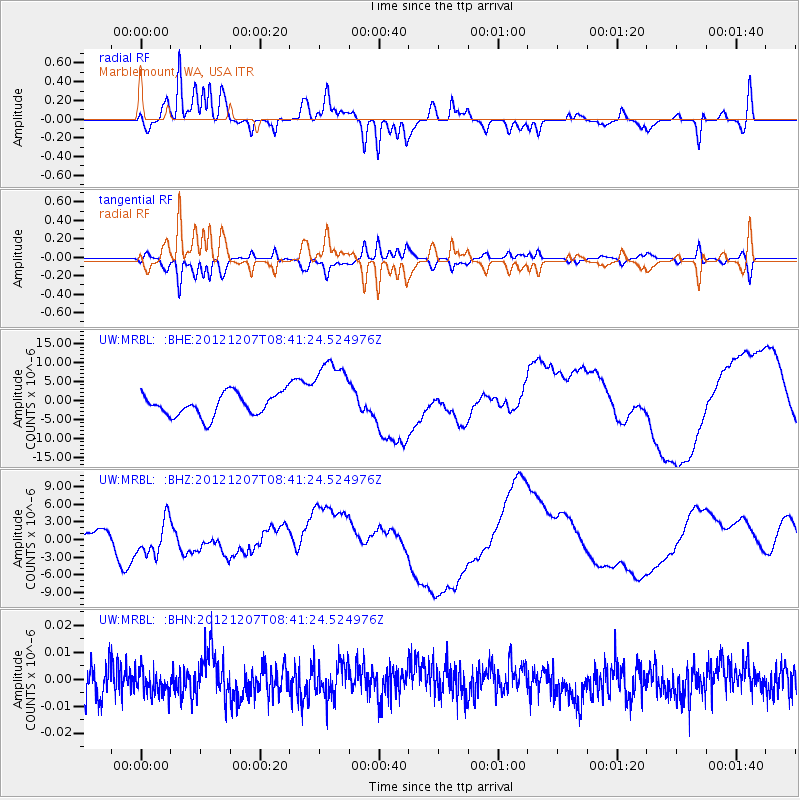
MRBL Marblemount, WA, USA - Earthquake Result Viewer
*The percent match for this event was below the threshold and hence no stack was calculated.
| Earthquake location: |
Off East Coast Of Honshu, Japan |
| Earthquake latitude/longitude: |
37.9/143.8 |
| Earthquake time(UTC): |
2012/12/07 (342) 08:31:14 GMT |
| Earthquake Depth: |
32 km |
| Earthquake Magnitude: |
6.1 MB, 6.2 MW, 6.2 MW |
| Earthquake Catalog/Contributor: |
WHDF/NEIC |
|
| Network: |
UW Pacific Northwest Regional Seismic Network |
| Station: |
MRBL Marblemount, WA, USA |
| Lat/Lon: |
48.52 N/121.48 W |
| Elevation: |
75 m |
|
| Distance: |
65.6 deg |
| Az: |
46.696 deg |
| Baz: |
300.038 deg |
| Ray Param: |
$rayparam |
*The percent match for this event was below the threshold and hence was not used in the summary stack. |
|
| Radial Match: |
77.1381 % |
| Radial Bump: |
359 |
| Transverse Match: |
77.1129 % |
| Transverse Bump: |
345 |
| SOD ConfigId: |
488671 |
| Insert Time: |
2013-03-29 05:14:33.562 +0000 |
| GWidth: |
2.5 |
| Max Bumps: |
400 |
| Tol: |
0.001 |
|
Signal To Noise
| Channel | StoN | STA | LTA |
| UW:MRBL: :BHZ:20121207T08:41:24.524976Z | 1.8731594 | 3.032755E-6 | 1.6190587E-6 |
| UW:MRBL: :BHN:20121207T08:41:24.524976Z | 0.8002122 | 4.602387E-9 | 5.751458E-9 |
| UW:MRBL: :BHE:20121207T08:41:24.524976Z | 3.248442 | 9.496116E-6 | 2.9232835E-6 |
| Arrivals |
| Ps | |
| PpPs | |
| PsPs/PpSs | |


