You are here: Home > Network List > TA - USArray Transportable Network (new EarthScope stations) Stations List
> Station 147A Livingston, AL, USA > Earthquake Result Viewer
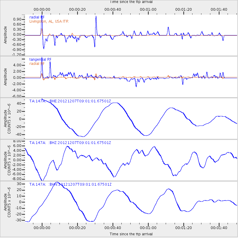
147A Livingston, AL, USA - Earthquake Result Viewer
*The percent match for this event was below the threshold and hence no stack was calculated.
| Earthquake location: |
Off East Coast Of Honshu, Japan |
| Earthquake latitude/longitude: |
37.8/143.6 |
| Earthquake time(UTC): |
2012/12/07 (342) 08:48:13 GMT |
| Earthquake Depth: |
20 km |
| Earthquake Magnitude: |
5.5 MB |
| Earthquake Catalog/Contributor: |
WHDF/NEIC |
|
| Network: |
TA USArray Transportable Network (new EarthScope stations) |
| Station: |
147A Livingston, AL, USA |
| Lat/Lon: |
32.67 N/88.27 W |
| Elevation: |
57 m |
|
| Distance: |
94.8 deg |
| Az: |
41.748 deg |
| Baz: |
321.306 deg |
| Ray Param: |
$rayparam |
*The percent match for this event was below the threshold and hence was not used in the summary stack. |
|
| Radial Match: |
82.27095 % |
| Radial Bump: |
400 |
| Transverse Match: |
71.3199 % |
| Transverse Bump: |
328 |
| SOD ConfigId: |
488671 |
| Insert Time: |
2013-03-29 05:22:59.838 +0000 |
| GWidth: |
2.5 |
| Max Bumps: |
400 |
| Tol: |
0.001 |
|
Signal To Noise
| Channel | StoN | STA | LTA |
| TA:147A: :BHZ:20121207T09:01:01.67501Z | 2.3351316 | 7.423242E-6 | 3.1789396E-6 |
| TA:147A: :BHN:20121207T09:01:01.67501Z | 0.39536226 | 9.767267E-6 | 2.4704603E-5 |
| TA:147A: :BHE:20121207T09:01:01.67501Z | 0.36773735 | 1.2833029E-5 | 3.4897268E-5 |
| Arrivals |
| Ps | |
| PpPs | |
| PsPs/PpSs | |


