You are here: Home > Network List > TA - USArray Transportable Network (new EarthScope stations) Stations List
> Station Z51A Franklin, GA, USA > Earthquake Result Viewer
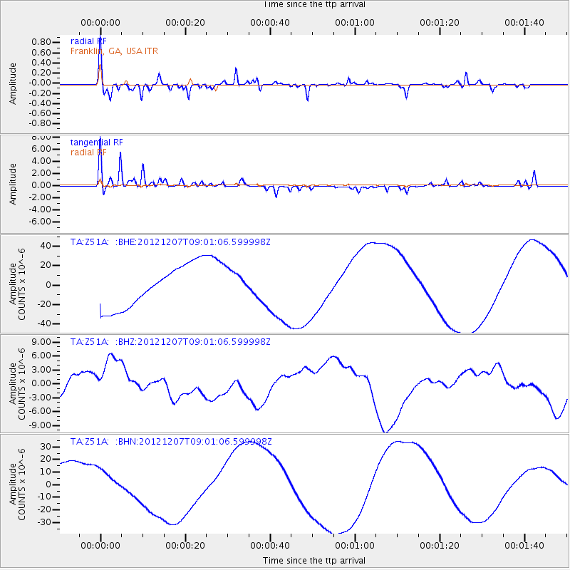
Z51A Franklin, GA, USA - Earthquake Result Viewer
*The percent match for this event was below the threshold and hence no stack was calculated.
| Earthquake location: |
Off East Coast Of Honshu, Japan |
| Earthquake latitude/longitude: |
37.8/143.6 |
| Earthquake time(UTC): |
2012/12/07 (342) 08:48:13 GMT |
| Earthquake Depth: |
20 km |
| Earthquake Magnitude: |
5.5 MB |
| Earthquake Catalog/Contributor: |
WHDF/NEIC |
|
| Network: |
TA USArray Transportable Network (new EarthScope stations) |
| Station: |
Z51A Franklin, GA, USA |
| Lat/Lon: |
33.32 N/85.17 W |
| Elevation: |
249 m |
|
| Distance: |
95.9 deg |
| Az: |
39.288 deg |
| Baz: |
323.215 deg |
| Ray Param: |
$rayparam |
*The percent match for this event was below the threshold and hence was not used in the summary stack. |
|
| Radial Match: |
78.81634 % |
| Radial Bump: |
285 |
| Transverse Match: |
61.787193 % |
| Transverse Bump: |
249 |
| SOD ConfigId: |
488671 |
| Insert Time: |
2013-03-29 05:26:10.622 +0000 |
| GWidth: |
2.5 |
| Max Bumps: |
400 |
| Tol: |
0.001 |
|
Signal To Noise
| Channel | StoN | STA | LTA |
| TA:Z51A: :BHZ:20121207T09:01:06.599998Z | 2.4861984 | 5.827429E-6 | 2.3439113E-6 |
| TA:Z51A: :BHN:20121207T09:01:06.599998Z | 0.68047625 | 1.0874984E-5 | 1.598143E-5 |
| TA:Z51A: :BHE:20121207T09:01:06.599998Z | 0.6983271 | 1.51769555E-5 | 2.1733302E-5 |
| Arrivals |
| Ps | |
| PpPs | |
| PsPs/PpSs | |


