You are here: Home > Network List > TA - USArray Transportable Network (new EarthScope stations) Stations List
> Station J01E Myrtle Point, OR, USA > Earthquake Result Viewer
J01E Myrtle Point, OR, USA - Earthquake Result Viewer
*The percent match for this event was below the threshold and hence no stack was calculated.
| Earthquake location: |
Eastern New Guinea Reg., P.N.G. |
| Earthquake latitude/longitude: |
-7.7/147.0 |
| Earthquake time(UTC): |
2012/12/07 (342) 19:50:23 GMT |
| Earthquake Depth: |
140 km |
| Earthquake Magnitude: |
5.5 MB, 5.7 MW |
| Earthquake Catalog/Contributor: |
WHDF/NEIC |
|
| Network: |
TA USArray Transportable Network (new EarthScope stations) |
| Station: |
J01E Myrtle Point, OR, USA |
| Lat/Lon: |
43.16 N/123.93 W |
| Elevation: |
128 m |
|
| Distance: |
94.5 deg |
| Az: |
47.217 deg |
| Baz: |
263.818 deg |
| Ray Param: |
$rayparam |
*The percent match for this event was below the threshold and hence was not used in the summary stack. |
|
| Radial Match: |
62.184544 % |
| Radial Bump: |
400 |
| Transverse Match: |
49.6763 % |
| Transverse Bump: |
400 |
| SOD ConfigId: |
488671 |
| Insert Time: |
2013-03-29 05:40:15.052 +0000 |
| GWidth: |
2.5 |
| Max Bumps: |
400 |
| Tol: |
0.001 |
|
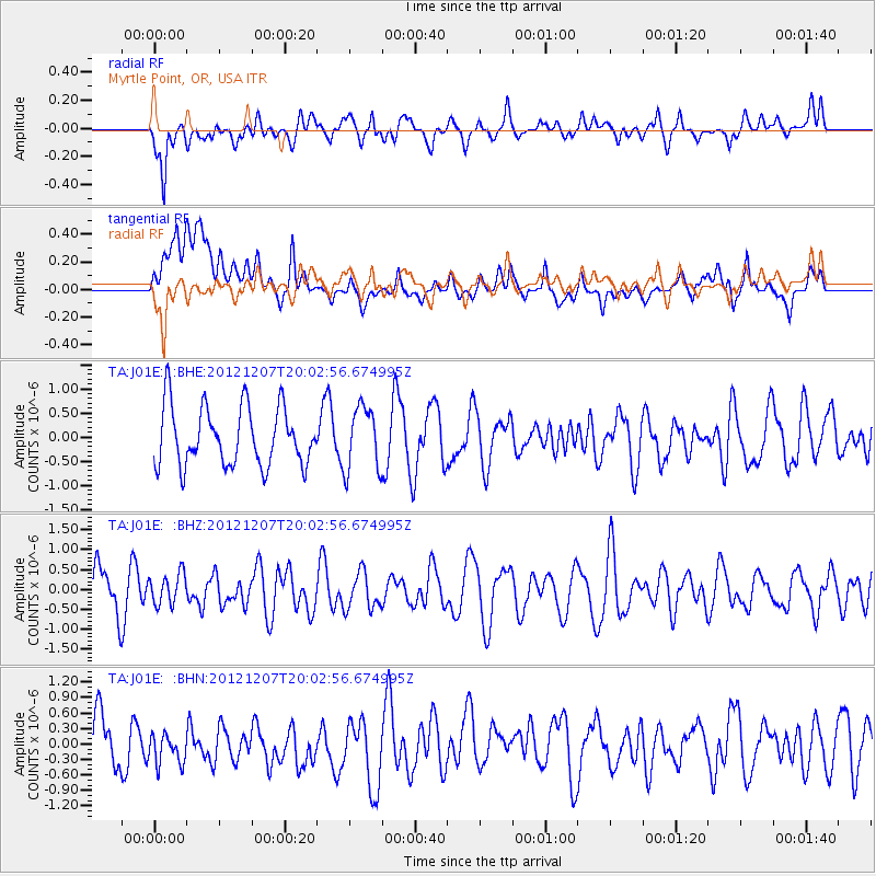
Signal To Noise
| Channel | StoN | STA | LTA |
| TA:J01E: :BHZ:20121207T20:02:56.674995Z | 0.5656545 | 3.9230912E-7 | 6.93549E-7 |
| TA:J01E: :BHN:20121207T20:02:56.674995Z | 0.79502857 | 5.2652877E-7 | 6.6227653E-7 |
| TA:J01E: :BHE:20121207T20:02:56.674995Z | 1.0859635 | 6.6342335E-7 | 6.109076E-7 |
| Arrivals |
| Ps | |
| PpPs | |
| PsPs/PpSs | |


