You are here: Home > Network List > UW - Pacific Northwest Regional Seismic Network Stations List
> Station LEBA Lebam, WA, USA > Earthquake Result Viewer
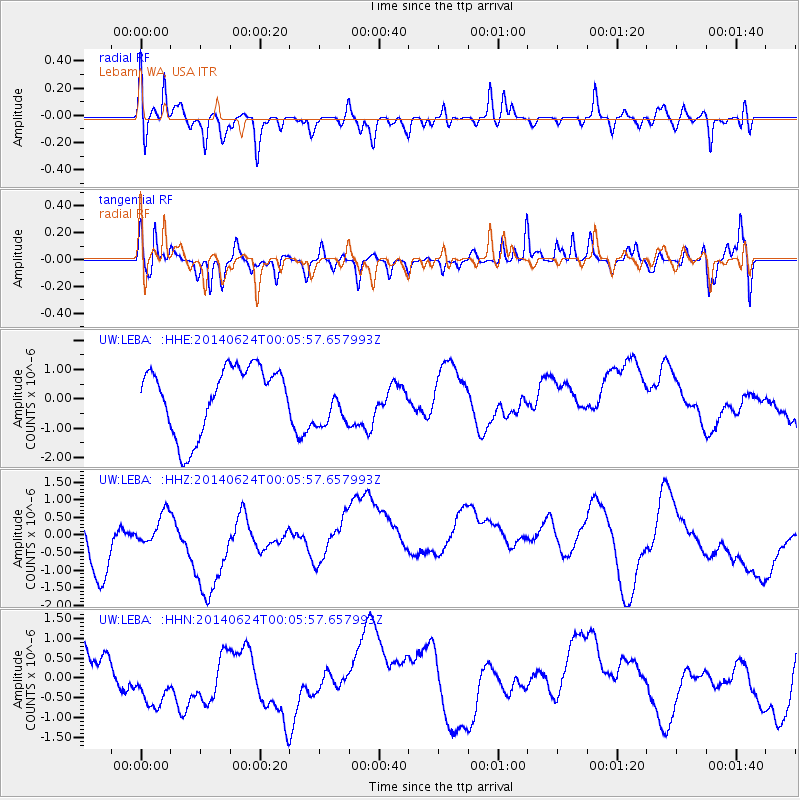
LEBA Lebam, WA, USA - Earthquake Result Viewer
*The percent match for this event was below the threshold and hence no stack was calculated.
| Earthquake location: |
Kermadec Islands, New Zealand |
| Earthquake latitude/longitude: |
-30.2/-177.5 |
| Earthquake time(UTC): |
2014/06/23 (174) 23:53:27 GMT |
| Earthquake Depth: |
10 km |
| Earthquake Magnitude: |
5.2 mb |
| Earthquake Catalog/Contributor: |
ISC/ISC |
|
| Network: |
UW Pacific Northwest Regional Seismic Network |
| Station: |
LEBA Lebam, WA, USA |
| Lat/Lon: |
46.55 N/123.56 W |
| Elevation: |
73 m |
|
| Distance: |
90.6 deg |
| Az: |
33.902 deg |
| Baz: |
224.42 deg |
| Ray Param: |
$rayparam |
*The percent match for this event was below the threshold and hence was not used in the summary stack. |
|
| Radial Match: |
51.759975 % |
| Radial Bump: |
364 |
| Transverse Match: |
53.60527 % |
| Transverse Bump: |
400 |
| SOD ConfigId: |
3390531 |
| Insert Time: |
2019-04-12 11:57:48.105 +0000 |
| GWidth: |
2.5 |
| Max Bumps: |
400 |
| Tol: |
0.001 |
|
Signal To Noise
| Channel | StoN | STA | LTA |
| UW:LEBA: :HHZ:20140624T00:05:57.657993Z | 0.4543148 | 4.858782E-7 | 1.0694747E-6 |
| UW:LEBA: :HHN:20140624T00:05:57.657993Z | 1.9903486 | 8.775554E-7 | 4.4090538E-7 |
| UW:LEBA: :HHE:20140624T00:05:57.657993Z | 0.74584186 | 8.274229E-7 | 1.1093812E-6 |
| Arrivals |
| Ps | |
| PpPs | |
| PsPs/PpSs | |


