You are here: Home > Network List > TA - USArray Transportable Network (new EarthScope stations) Stations List
> Station L40A Anamosa, IA, USA > Earthquake Result Viewer
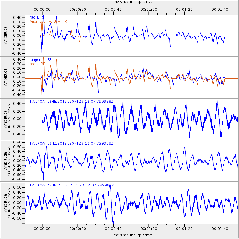
L40A Anamosa, IA, USA - Earthquake Result Viewer
*The percent match for this event was below the threshold and hence no stack was calculated.
| Earthquake location: |
Off East Coast Of Honshu, Japan |
| Earthquake latitude/longitude: |
37.7/143.8 |
| Earthquake time(UTC): |
2012/12/07 (342) 23:00:00 GMT |
| Earthquake Depth: |
24 km |
| Earthquake Magnitude: |
5.5 MB, 5.2 MW |
| Earthquake Catalog/Contributor: |
WHDF/NEIC |
|
| Network: |
TA USArray Transportable Network (new EarthScope stations) |
| Station: |
L40A Anamosa, IA, USA |
| Lat/Lon: |
42.06 N/91.22 W |
| Elevation: |
242 m |
|
| Distance: |
86.1 deg |
| Az: |
37.682 deg |
| Baz: |
319.398 deg |
| Ray Param: |
$rayparam |
*The percent match for this event was below the threshold and hence was not used in the summary stack. |
|
| Radial Match: |
64.637535 % |
| Radial Bump: |
400 |
| Transverse Match: |
62.840073 % |
| Transverse Bump: |
400 |
| SOD ConfigId: |
488671 |
| Insert Time: |
2013-03-29 05:50:13.693 +0000 |
| GWidth: |
2.5 |
| Max Bumps: |
400 |
| Tol: |
0.001 |
|
Signal To Noise
| Channel | StoN | STA | LTA |
| TA:L40A: :BHZ:20121207T23:12:07.799988Z | 2.015838 | 3.8617574E-7 | 1.9157083E-7 |
| TA:L40A: :BHN:20121207T23:12:07.799988Z | 0.7483958 | 1.6408265E-7 | 2.1924582E-7 |
| TA:L40A: :BHE:20121207T23:12:07.799988Z | 0.8699832 | 1.4010283E-7 | 1.6104084E-7 |
| Arrivals |
| Ps | |
| PpPs | |
| PsPs/PpSs | |


