You are here: Home > Network List > TA - USArray Transportable Network (new EarthScope stations) Stations List
> Station I39A Houston, MN, USA > Earthquake Result Viewer
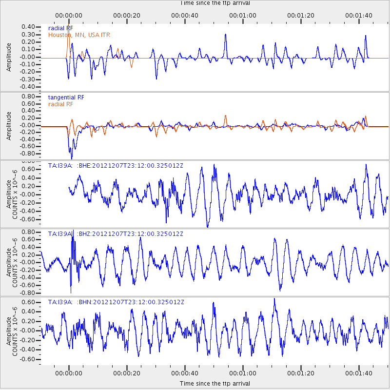
I39A Houston, MN, USA - Earthquake Result Viewer
*The percent match for this event was below the threshold and hence no stack was calculated.
| Earthquake location: |
Off East Coast Of Honshu, Japan |
| Earthquake latitude/longitude: |
37.7/143.8 |
| Earthquake time(UTC): |
2012/12/07 (342) 23:00:00 GMT |
| Earthquake Depth: |
24 km |
| Earthquake Magnitude: |
5.5 MB, 5.2 MW |
| Earthquake Catalog/Contributor: |
WHDF/NEIC |
|
| Network: |
TA USArray Transportable Network (new EarthScope stations) |
| Station: |
I39A Houston, MN, USA |
| Lat/Lon: |
43.85 N/91.52 W |
| Elevation: |
393 m |
|
| Distance: |
84.6 deg |
| Az: |
36.677 deg |
| Baz: |
319.112 deg |
| Ray Param: |
$rayparam |
*The percent match for this event was below the threshold and hence was not used in the summary stack. |
|
| Radial Match: |
40.374718 % |
| Radial Bump: |
400 |
| Transverse Match: |
68.5541 % |
| Transverse Bump: |
400 |
| SOD ConfigId: |
488671 |
| Insert Time: |
2013-03-29 05:50:31.651 +0000 |
| GWidth: |
2.5 |
| Max Bumps: |
400 |
| Tol: |
0.001 |
|
Signal To Noise
| Channel | StoN | STA | LTA |
| TA:I39A: :BHZ:20121207T23:12:00.325012Z | 1.7564994 | 3.122134E-7 | 1.7774751E-7 |
| TA:I39A: :BHN:20121207T23:12:00.325012Z | 0.9757969 | 1.7099259E-7 | 1.752338E-7 |
| TA:I39A: :BHE:20121207T23:12:00.325012Z | 1.4633001 | 2.7555762E-7 | 1.8831246E-7 |
| Arrivals |
| Ps | |
| PpPs | |
| PsPs/PpSs | |


