You are here: Home > Network List > TA - USArray Transportable Network (new EarthScope stations) Stations List
> Station R49A Shelbyville, KY, USA > Earthquake Result Viewer
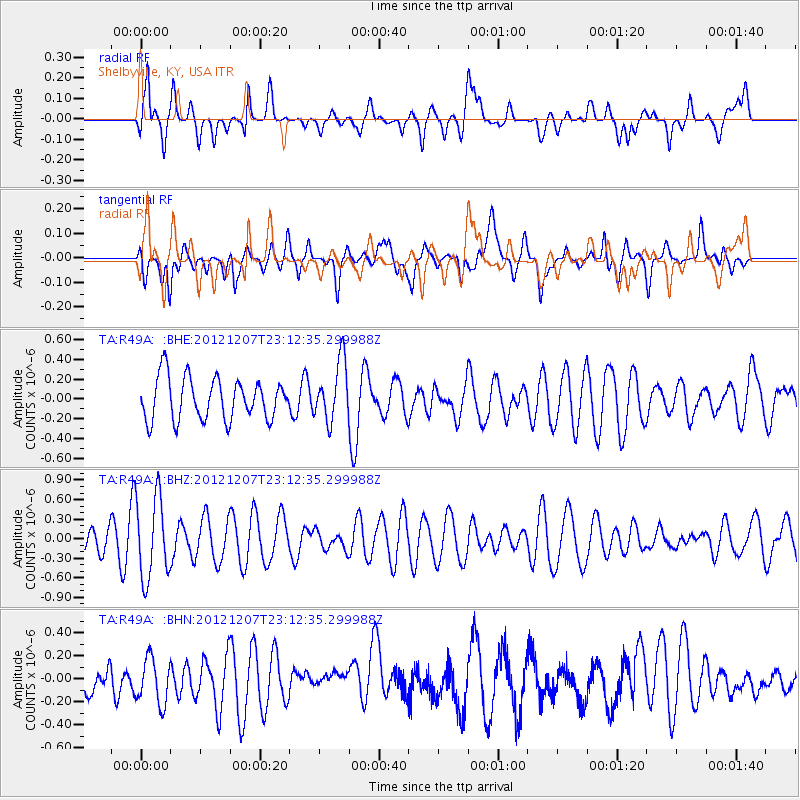
R49A Shelbyville, KY, USA - Earthquake Result Viewer
*The percent match for this event was below the threshold and hence no stack was calculated.
| Earthquake location: |
Off East Coast Of Honshu, Japan |
| Earthquake latitude/longitude: |
37.7/143.8 |
| Earthquake time(UTC): |
2012/12/07 (342) 23:00:00 GMT |
| Earthquake Depth: |
24 km |
| Earthquake Magnitude: |
5.5 MB, 5.2 MW |
| Earthquake Catalog/Contributor: |
WHDF/NEIC |
|
| Network: |
TA USArray Transportable Network (new EarthScope stations) |
| Station: |
R49A Shelbyville, KY, USA |
| Lat/Lon: |
38.29 N/85.17 W |
| Elevation: |
251 m |
|
| Distance: |
91.9 deg |
| Az: |
36.413 deg |
| Baz: |
323.269 deg |
| Ray Param: |
$rayparam |
*The percent match for this event was below the threshold and hence was not used in the summary stack. |
|
| Radial Match: |
58.48274 % |
| Radial Bump: |
400 |
| Transverse Match: |
55.533066 % |
| Transverse Bump: |
400 |
| SOD ConfigId: |
488671 |
| Insert Time: |
2013-03-29 05:51:57.463 +0000 |
| GWidth: |
2.5 |
| Max Bumps: |
400 |
| Tol: |
0.001 |
|
Signal To Noise
| Channel | StoN | STA | LTA |
| TA:R49A: :BHZ:20121207T23:12:35.299988Z | 2.8673706 | 6.2835466E-7 | 2.1913966E-7 |
| TA:R49A: :BHN:20121207T23:12:35.299988Z | 0.9911139 | 2.024376E-7 | 2.042526E-7 |
| TA:R49A: :BHE:20121207T23:12:35.299988Z | 1.4453671 | 3.0355136E-7 | 2.100168E-7 |
| Arrivals |
| Ps | |
| PpPs | |
| PsPs/PpSs | |


