You are here: Home > Network List > CN - Canadian National Seismograph Network Stations List
> Station INK INUVIK, NT > Earthquake Result Viewer
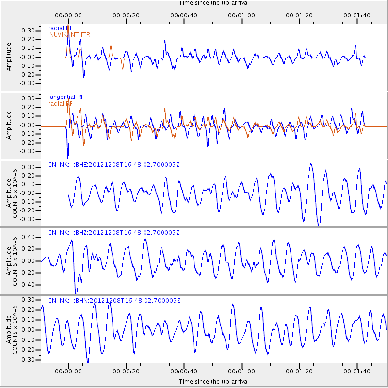
INK INUVIK, NT - Earthquake Result Viewer
*The percent match for this event was below the threshold and hence no stack was calculated.
| Earthquake location: |
Near S Coast Of New Guinea, P.N.G. |
| Earthquake latitude/longitude: |
-7.2/144.0 |
| Earthquake time(UTC): |
2012/12/08 (343) 16:35:16 GMT |
| Earthquake Depth: |
10 km |
| Earthquake Magnitude: |
5.7 MB, 5.6 MS, 5.6 MW, 5.6 MW |
| Earthquake Catalog/Contributor: |
WHDF/NEIC |
|
| Network: |
CN Canadian National Seismograph Network |
| Station: |
INK INUVIK, NT |
| Lat/Lon: |
68.31 N/133.53 W |
| Elevation: |
44 m |
|
| Distance: |
93.9 deg |
| Az: |
21.682 deg |
| Baz: |
260.39 deg |
| Ray Param: |
$rayparam |
*The percent match for this event was below the threshold and hence was not used in the summary stack. |
|
| Radial Match: |
50.168156 % |
| Radial Bump: |
380 |
| Transverse Match: |
60.100067 % |
| Transverse Bump: |
400 |
| SOD ConfigId: |
488671 |
| Insert Time: |
2013-03-29 05:57:03.702 +0000 |
| GWidth: |
2.5 |
| Max Bumps: |
400 |
| Tol: |
0.001 |
|
Signal To Noise
| Channel | StoN | STA | LTA |
| CN:INK: :BHZ:20121208T16:48:02.700005Z | 3.0666473 | 3.1266347E-7 | 1.01956125E-7 |
| CN:INK: :BHN:20121208T16:48:02.700005Z | 0.835042 | 1.1653976E-7 | 1.3956155E-7 |
| CN:INK: :BHE:20121208T16:48:02.700005Z | 1.2662623 | 1.1619482E-7 | 9.176205E-8 |
| Arrivals |
| Ps | |
| PpPs | |
| PsPs/PpSs | |


