You are here: Home > Network List > TA - USArray Transportable Network (new EarthScope stations) Stations List
> Station O03E Paynes Creek, CA, USA > Earthquake Result Viewer
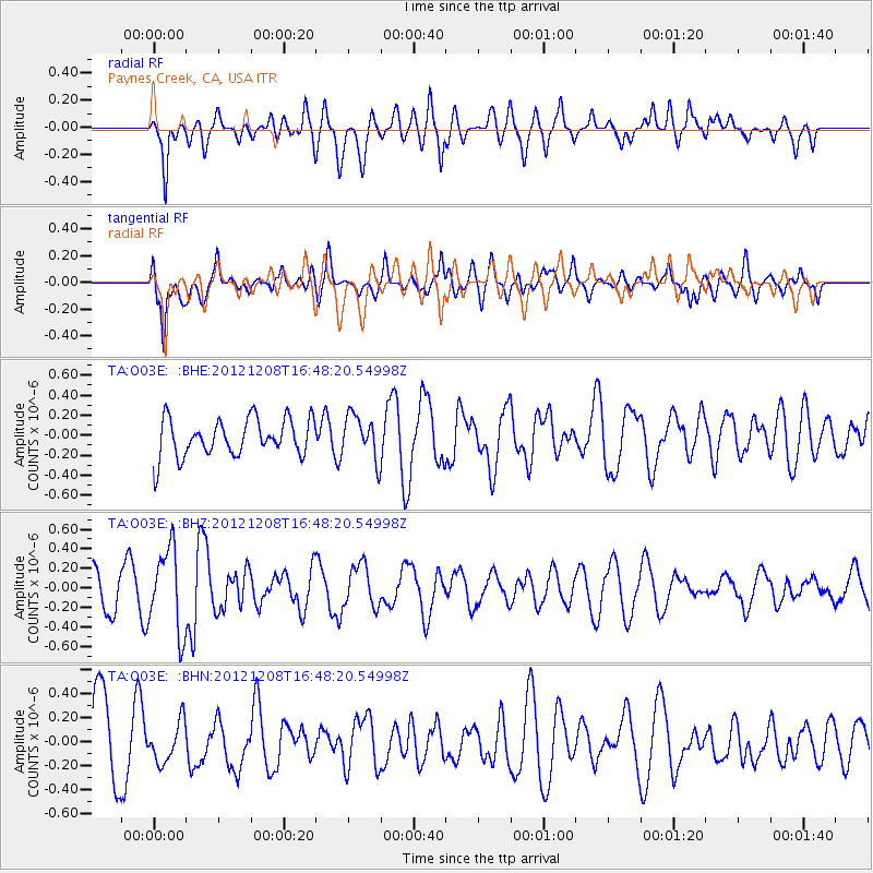
O03E Paynes Creek, CA, USA - Earthquake Result Viewer
*The percent match for this event was below the threshold and hence no stack was calculated.
| Earthquake location: |
Near S Coast Of New Guinea, P.N.G. |
| Earthquake latitude/longitude: |
-7.2/144.0 |
| Earthquake time(UTC): |
2012/12/08 (343) 16:35:16 GMT |
| Earthquake Depth: |
10 km |
| Earthquake Magnitude: |
5.7 MB, 5.6 MS, 5.6 MW, 5.6 MW |
| Earthquake Catalog/Contributor: |
WHDF/NEIC |
|
| Network: |
TA USArray Transportable Network (new EarthScope stations) |
| Station: |
O03E Paynes Creek, CA, USA |
| Lat/Lon: |
40.29 N/121.80 W |
| Elevation: |
967 m |
|
| Distance: |
97.8 deg |
| Az: |
50.351 deg |
| Baz: |
267.206 deg |
| Ray Param: |
$rayparam |
*The percent match for this event was below the threshold and hence was not used in the summary stack. |
|
| Radial Match: |
64.052246 % |
| Radial Bump: |
400 |
| Transverse Match: |
61.8078 % |
| Transverse Bump: |
400 |
| SOD ConfigId: |
488671 |
| Insert Time: |
2013-03-29 05:59:45.135 +0000 |
| GWidth: |
2.5 |
| Max Bumps: |
400 |
| Tol: |
0.001 |
|
Signal To Noise
| Channel | StoN | STA | LTA |
| TA:O03E: :BHZ:20121208T16:48:20.54998Z | 2.5174675 | 4.2656228E-7 | 1.6944102E-7 |
| TA:O03E: :BHN:20121208T16:48:20.54998Z | 0.71668273 | 1.6418625E-7 | 2.2909195E-7 |
| TA:O03E: :BHE:20121208T16:48:20.54998Z | 1.1754805 | 2.1848089E-7 | 1.8586518E-7 |
| Arrivals |
| Ps | |
| PpPs | |
| PsPs/PpSs | |


