You are here: Home > Network List > IC - New China Digital Seismograph Network Stations List
> Station WMQ Urumqi, Xinjiang Province, China > Earthquake Result Viewer
WMQ Urumqi, Xinjiang Province, China - Earthquake Result Viewer

| Earthquake location: |
Banda Sea |
| Earthquake latitude/longitude: |
-6.5/129.8 |
| Earthquake time(UTC): |
2012/12/10 (345) 16:53:08 GMT |
| Earthquake Depth: |
155 km |
| Earthquake Magnitude: |
6.6 MB, 7.1 MW, 7.1 MW |
| Earthquake Catalog/Contributor: |
WHDF/NEIC |
|
| Network: |
IC New China Digital Seismograph Network |
| Station: |
WMQ Urumqi, Xinjiang Province, China |
| Lat/Lon: |
43.81 N/87.70 E |
| Elevation: |
850 m |
|
| Distance: |
62.9 deg |
| Az: |
326.948 deg |
| Baz: |
131.533 deg |
| Ray Param: |
0.059471484 |
| Estimated Moho Depth: |
47.0 km |
| Estimated Crust Vp/Vs: |
1.88 |
| Assumed Crust Vp: |
6.242 km/s |
| Estimated Crust Vs: |
3.329 km/s |
| Estimated Crust Poisson's Ratio: |
0.30 |
|
| Radial Match: |
94.90824 % |
| Radial Bump: |
398 |
| Transverse Match: |
92.509796 % |
| Transverse Bump: |
400 |
| SOD ConfigId: |
491031 |
| Insert Time: |
2013-04-02 15:02:54.811 +0000 |
| GWidth: |
2.5 |
| Max Bumps: |
400 |
| Tol: |
0.001 |
|
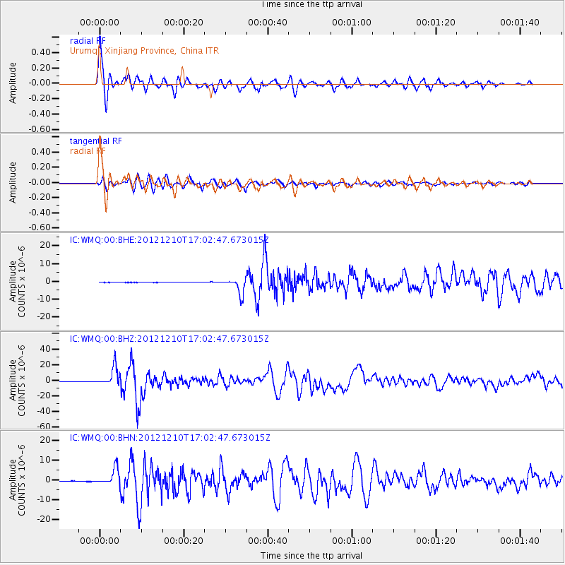
Signal To Noise
| Channel | StoN | STA | LTA |
| IC:WMQ:00:BHZ:20121210T17:02:47.673015Z | 69.611916 | 1.1856036E-5 | 1.7031618E-7 |
| IC:WMQ:00:BHN:20121210T17:02:47.673015Z | 50.259205 | 4.2672405E-6 | 8.490466E-8 |
| IC:WMQ:00:BHE:20121210T17:02:47.673015Z | 52.457466 | 4.525372E-6 | 8.6267455E-8 |
| Arrivals |
| Ps | 6.8 SECOND |
| PpPs | 21 SECOND |
| PsPs/PpSs | 28 SECOND |


