You are here: Home > Network List > CI - Caltech Regional Seismic Network Stations List
> Station IRM Iron Mountain Pumping Station, Eagle Mtn., CA, USA > Earthquake Result Viewer
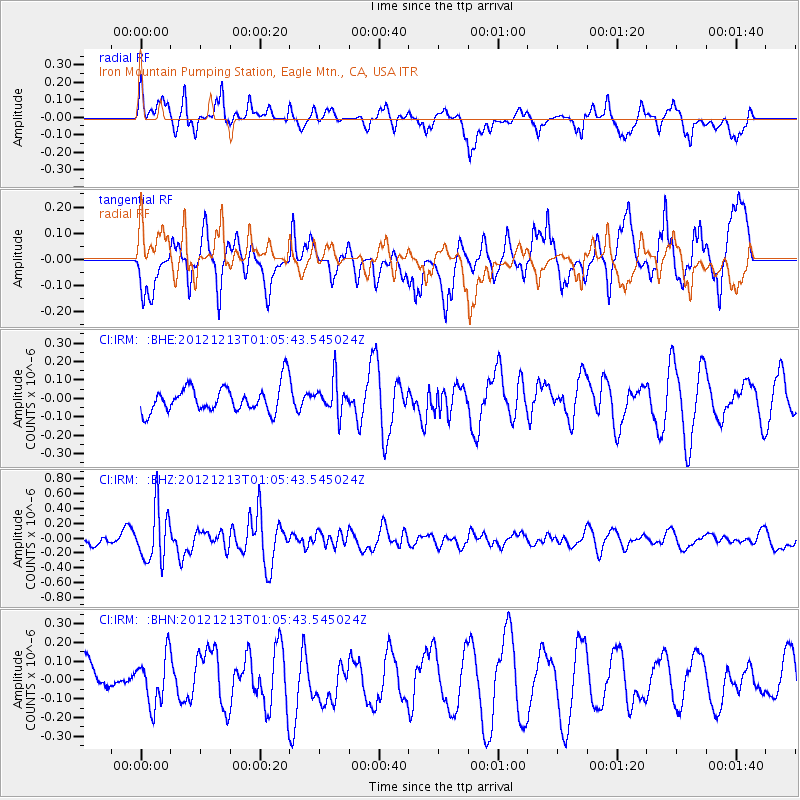
IRM Iron Mountain Pumping Station, Eagle Mtn., CA, USA - Earthquake Result Viewer
*The percent match for this event was below the threshold and hence no stack was calculated.
| Earthquake location: |
Kermadec Islands, New Zealand |
| Earthquake latitude/longitude: |
-30.9/-178.4 |
| Earthquake time(UTC): |
2012/12/13 (348) 00:53:28 GMT |
| Earthquake Depth: |
39 km |
| Earthquake Magnitude: |
5.5 MB, 4.9 MS, 5.3 MW, 5.4 MW |
| Earthquake Catalog/Contributor: |
WHDF/NEIC |
|
| Network: |
CI Caltech Regional Seismic Network |
| Station: |
IRM Iron Mountain Pumping Station, Eagle Mtn., CA, USA |
| Lat/Lon: |
34.16 N/115.15 W |
| Elevation: |
567 m |
|
| Distance: |
88.0 deg |
| Az: |
47.81 deg |
| Baz: |
230.169 deg |
| Ray Param: |
$rayparam |
*The percent match for this event was below the threshold and hence was not used in the summary stack. |
|
| Radial Match: |
39.74287 % |
| Radial Bump: |
354 |
| Transverse Match: |
60.300426 % |
| Transverse Bump: |
337 |
| SOD ConfigId: |
491031 |
| Insert Time: |
2013-04-02 15:15:08.760 +0000 |
| GWidth: |
2.5 |
| Max Bumps: |
400 |
| Tol: |
0.001 |
|
Signal To Noise
| Channel | StoN | STA | LTA |
| CI:IRM: :BHZ:20121213T01:05:43.545024Z | 2.5123518 | 3.600274E-7 | 1.4330294E-7 |
| CI:IRM: :BHN:20121213T01:05:43.545024Z | 0.5394451 | 1.2997431E-7 | 2.4094075E-7 |
| CI:IRM: :BHE:20121213T01:05:43.545024Z | 1.2288265 | 8.780174E-8 | 7.1451694E-8 |
| Arrivals |
| Ps | |
| PpPs | |
| PsPs/PpSs | |


