You are here: Home > Network List > CI - Caltech Regional Seismic Network Stations List
> Station FUR Furnace Creek, CA, USA > Earthquake Result Viewer
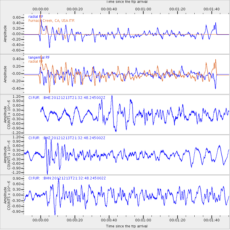
FUR Furnace Creek, CA, USA - Earthquake Result Viewer
*The percent match for this event was below the threshold and hence no stack was calculated.
| Earthquake location: |
El Salvador |
| Earthquake latitude/longitude: |
13.1/-90.0 |
| Earthquake time(UTC): |
2012/12/13 (348) 21:26:39 GMT |
| Earthquake Depth: |
10 km |
| Earthquake Magnitude: |
5.5 MB, 4.9 MS, 5.3 MW, 5.5 MW |
| Earthquake Catalog/Contributor: |
WHDF/NEIC |
|
| Network: |
CI Caltech Regional Seismic Network |
| Station: |
FUR Furnace Creek, CA, USA |
| Lat/Lon: |
36.47 N/116.86 W |
| Elevation: |
-37.0 m |
|
| Distance: |
33.5 deg |
| Az: |
318.7 deg |
| Baz: |
127.078 deg |
| Ray Param: |
$rayparam |
*The percent match for this event was below the threshold and hence was not used in the summary stack. |
|
| Radial Match: |
59.51725 % |
| Radial Bump: |
400 |
| Transverse Match: |
58.597237 % |
| Transverse Bump: |
400 |
| SOD ConfigId: |
491031 |
| Insert Time: |
2013-04-02 15:21:46.282 +0000 |
| GWidth: |
2.5 |
| Max Bumps: |
400 |
| Tol: |
0.001 |
|
Signal To Noise
| Channel | StoN | STA | LTA |
| CI:FUR: :BHZ:20121213T21:32:48.245002Z | 2.811905 | 5.298235E-7 | 1.8842157E-7 |
| CI:FUR: :BHN:20121213T21:32:48.245002Z | 1.016798 | 2.0783189E-7 | 2.043984E-7 |
| CI:FUR: :BHE:20121213T21:32:48.245002Z | 1.1293095 | 3.2524645E-7 | 2.880047E-7 |
| Arrivals |
| Ps | |
| PpPs | |
| PsPs/PpSs | |


