You are here: Home > Network List > TA - USArray Transportable Network (new EarthScope stations) Stations List
> Station I49A Point Hope, MI, USA > Earthquake Result Viewer
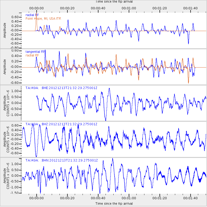
I49A Point Hope, MI, USA - Earthquake Result Viewer
*The percent match for this event was below the threshold and hence no stack was calculated.
| Earthquake location: |
El Salvador |
| Earthquake latitude/longitude: |
13.1/-90.0 |
| Earthquake time(UTC): |
2012/12/13 (348) 21:26:39 GMT |
| Earthquake Depth: |
10 km |
| Earthquake Magnitude: |
5.5 MB, 4.9 MS, 5.3 MW, 5.5 MW |
| Earthquake Catalog/Contributor: |
WHDF/NEIC |
|
| Network: |
TA USArray Transportable Network (new EarthScope stations) |
| Station: |
I49A Point Hope, MI, USA |
| Lat/Lon: |
43.94 N/82.82 W |
| Elevation: |
217 m |
|
| Distance: |
31.4 deg |
| Az: |
9.936 deg |
| Baz: |
193.459 deg |
| Ray Param: |
$rayparam |
*The percent match for this event was below the threshold and hence was not used in the summary stack. |
|
| Radial Match: |
55.411335 % |
| Radial Bump: |
400 |
| Transverse Match: |
74.9553 % |
| Transverse Bump: |
400 |
| SOD ConfigId: |
491031 |
| Insert Time: |
2013-04-02 15:27:46.164 +0000 |
| GWidth: |
2.5 |
| Max Bumps: |
400 |
| Tol: |
0.001 |
|
Signal To Noise
| Channel | StoN | STA | LTA |
| TA:I49A: :BHZ:20121213T21:32:29.275001Z | 1.7946305 | 4.485665E-7 | 2.499492E-7 |
| TA:I49A: :BHN:20121213T21:32:29.275001Z | 1.1078603 | 5.398623E-7 | 4.8730175E-7 |
| TA:I49A: :BHE:20121213T21:32:29.275001Z | 1.0633252 | 4.8739685E-7 | 4.5837047E-7 |
| Arrivals |
| Ps | |
| PpPs | |
| PsPs/PpSs | |


