You are here: Home > Network List > TA - USArray Transportable Network (new EarthScope stations) Stations List
> Station F49A Sandfield, ON, CAN > Earthquake Result Viewer
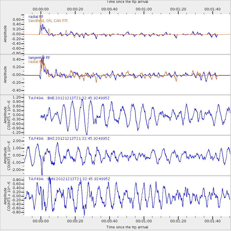
F49A Sandfield, ON, CAN - Earthquake Result Viewer
*The percent match for this event was below the threshold and hence no stack was calculated.
| Earthquake location: |
El Salvador |
| Earthquake latitude/longitude: |
13.1/-90.0 |
| Earthquake time(UTC): |
2012/12/13 (348) 21:26:39 GMT |
| Earthquake Depth: |
10 km |
| Earthquake Magnitude: |
5.5 MB, 4.9 MS, 5.3 MW, 5.5 MW |
| Earthquake Catalog/Contributor: |
WHDF/NEIC |
|
| Network: |
TA USArray Transportable Network (new EarthScope stations) |
| Station: |
F49A Sandfield, ON, CAN |
| Lat/Lon: |
45.76 N/82.04 W |
| Elevation: |
230 m |
|
| Distance: |
33.3 deg |
| Az: |
10.133 deg |
| Baz: |
194.175 deg |
| Ray Param: |
$rayparam |
*The percent match for this event was below the threshold and hence was not used in the summary stack. |
|
| Radial Match: |
71.663506 % |
| Radial Bump: |
400 |
| Transverse Match: |
75.55631 % |
| Transverse Bump: |
400 |
| SOD ConfigId: |
491031 |
| Insert Time: |
2013-04-02 15:28:24.394 +0000 |
| GWidth: |
2.5 |
| Max Bumps: |
400 |
| Tol: |
0.001 |
|
Signal To Noise
| Channel | StoN | STA | LTA |
| TA:F49A: :BHZ:20121213T21:32:45.924995Z | 1.7286403 | 9.4508806E-7 | 5.4672336E-7 |
| TA:F49A: :BHN:20121213T21:32:45.924995Z | 1.7728114 | 4.1063922E-7 | 2.3163165E-7 |
| TA:F49A: :BHE:20121213T21:32:45.924995Z | 0.86442995 | 4.5107996E-7 | 5.218236E-7 |
| Arrivals |
| Ps | |
| PpPs | |
| PsPs/PpSs | |


