You are here: Home > Network List > CI - Caltech Regional Seismic Network Stations List
> Station MPM Manuel Prospect Mine, California, USA > Earthquake Result Viewer
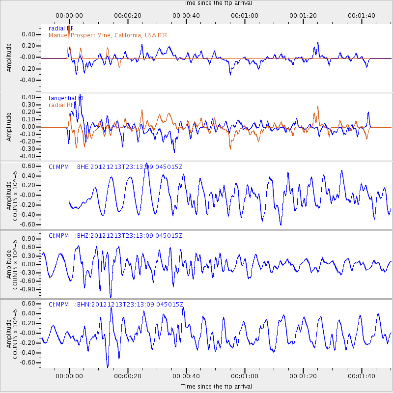
MPM Manuel Prospect Mine, California, USA - Earthquake Result Viewer
*The percent match for this event was below the threshold and hence no stack was calculated.
| Earthquake location: |
East Of Severnaya Zemlya |
| Earthquake latitude/longitude: |
80.8/121.4 |
| Earthquake time(UTC): |
2012/12/13 (348) 23:03:38 GMT |
| Earthquake Depth: |
10 km |
| Earthquake Magnitude: |
5.7 MB, 5.1 MS, 5.5 MW, 5.6 MW |
| Earthquake Catalog/Contributor: |
WHDF/NEIC |
|
| Network: |
CI Caltech Regional Seismic Network |
| Station: |
MPM Manuel Prospect Mine, California, USA |
| Lat/Lon: |
36.06 N/117.49 W |
| Elevation: |
185 m |
|
| Distance: |
59.3 deg |
| Az: |
53.798 deg |
| Baz: |
350.782 deg |
| Ray Param: |
$rayparam |
*The percent match for this event was below the threshold and hence was not used in the summary stack. |
|
| Radial Match: |
54.84185 % |
| Radial Bump: |
400 |
| Transverse Match: |
67.430824 % |
| Transverse Bump: |
400 |
| SOD ConfigId: |
491031 |
| Insert Time: |
2013-04-02 15:32:06.835 +0000 |
| GWidth: |
2.5 |
| Max Bumps: |
400 |
| Tol: |
0.001 |
|
Signal To Noise
| Channel | StoN | STA | LTA |
| CI:MPM: :BHZ:20121213T23:13:09.045015Z | 2.0891597 | 4.3724899E-7 | 2.092942E-7 |
| CI:MPM: :BHN:20121213T23:13:09.045015Z | 0.732129 | 1.6680278E-7 | 2.2783249E-7 |
| CI:MPM: :BHE:20121213T23:13:09.045015Z | 1.3544248 | 3.1164714E-7 | 2.3009555E-7 |
| Arrivals |
| Ps | |
| PpPs | |
| PsPs/PpSs | |


