You are here: Home > Network List > IW - Intermountain West Stations List
> Station MOOW Moose Ponds, Wyoming, USA > Earthquake Result Viewer
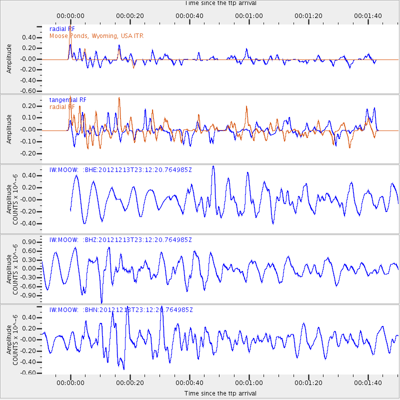
MOOW Moose Ponds, Wyoming, USA - Earthquake Result Viewer
*The percent match for this event was below the threshold and hence no stack was calculated.
| Earthquake location: |
East Of Severnaya Zemlya |
| Earthquake latitude/longitude: |
80.8/121.4 |
| Earthquake time(UTC): |
2012/12/13 (348) 23:03:38 GMT |
| Earthquake Depth: |
10 km |
| Earthquake Magnitude: |
5.7 MB, 5.1 MS, 5.5 MW, 5.6 MW |
| Earthquake Catalog/Contributor: |
WHDF/NEIC |
|
| Network: |
IW Intermountain West |
| Station: |
MOOW Moose Ponds, Wyoming, USA |
| Lat/Lon: |
43.75 N/110.74 W |
| Elevation: |
2128 m |
|
| Distance: |
52.5 deg |
| Az: |
46.129 deg |
| Baz: |
350.792 deg |
| Ray Param: |
$rayparam |
*The percent match for this event was below the threshold and hence was not used in the summary stack. |
|
| Radial Match: |
53.684776 % |
| Radial Bump: |
400 |
| Transverse Match: |
46.186253 % |
| Transverse Bump: |
400 |
| SOD ConfigId: |
491031 |
| Insert Time: |
2013-04-02 15:34:35.693 +0000 |
| GWidth: |
2.5 |
| Max Bumps: |
400 |
| Tol: |
0.001 |
|
Signal To Noise
| Channel | StoN | STA | LTA |
| IW:MOOW: :BHZ:20121213T23:12:20.764985Z | 1.786944 | 5.28997E-7 | 2.9603447E-7 |
| IW:MOOW: :BHN:20121213T23:12:20.764985Z | 0.7871438 | 1.2738283E-7 | 1.6182916E-7 |
| IW:MOOW: :BHE:20121213T23:12:20.764985Z | 0.38340083 | 7.6985636E-8 | 2.0079673E-7 |
| Arrivals |
| Ps | |
| PpPs | |
| PsPs/PpSs | |


