You are here: Home > Network List > TA - USArray Transportable Network (new EarthScope stations) Stations List
> Station R42A Luebbering, MO, USA > Earthquake Result Viewer
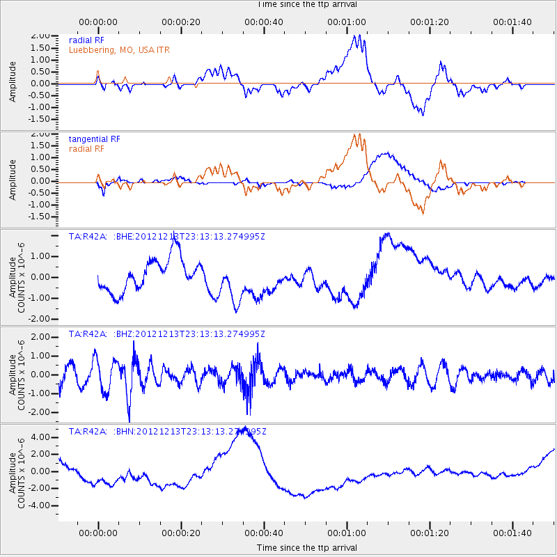
R42A Luebbering, MO, USA - Earthquake Result Viewer
*The percent match for this event was below the threshold and hence no stack was calculated.
| Earthquake location: |
East Of Severnaya Zemlya |
| Earthquake latitude/longitude: |
80.8/121.4 |
| Earthquake time(UTC): |
2012/12/13 (348) 23:03:38 GMT |
| Earthquake Depth: |
10 km |
| Earthquake Magnitude: |
5.7 MB, 5.1 MS, 5.5 MW, 5.6 MW |
| Earthquake Catalog/Contributor: |
WHDF/NEIC |
|
| Network: |
TA USArray Transportable Network (new EarthScope stations) |
| Station: |
R42A Luebbering, MO, USA |
| Lat/Lon: |
38.28 N/90.79 W |
| Elevation: |
218 m |
|
| Distance: |
59.9 deg |
| Az: |
28.981 deg |
| Baz: |
354.316 deg |
| Ray Param: |
$rayparam |
*The percent match for this event was below the threshold and hence was not used in the summary stack. |
|
| Radial Match: |
8.780248 % |
| Radial Bump: |
400 |
| Transverse Match: |
28.099098 % |
| Transverse Bump: |
400 |
| SOD ConfigId: |
491031 |
| Insert Time: |
2013-04-02 15:40:40.482 +0000 |
| GWidth: |
2.5 |
| Max Bumps: |
400 |
| Tol: |
0.001 |
|
Signal To Noise
| Channel | StoN | STA | LTA |
| TA:R42A: :BHZ:20121213T23:13:13.274995Z | 1.6370411 | 8.593713E-7 | 5.2495403E-7 |
| TA:R42A: :BHN:20121213T23:13:13.274995Z | 3.73484 | 3.2717908E-6 | 8.7601904E-7 |
| TA:R42A: :BHE:20121213T23:13:13.274995Z | 1.3819631 | 1.067772E-6 | 7.726487E-7 |
| Arrivals |
| Ps | |
| PpPs | |
| PsPs/PpSs | |


