You are here: Home > Network List > NE - New England Seismic Network Stations List
> Station PQI Presque Isle, ME, USA > Earthquake Result Viewer
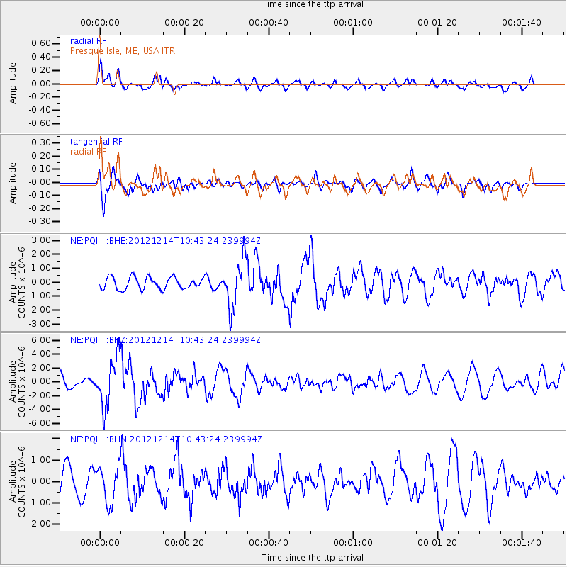
PQI Presque Isle, ME, USA - Earthquake Result Viewer
*The percent match for this event was below the threshold and hence no stack was calculated.
| Earthquake location: |
Off W. Coast Of Baja California |
| Earthquake latitude/longitude: |
31.1/-119.7 |
| Earthquake time(UTC): |
2012/12/14 (349) 10:36:01 GMT |
| Earthquake Depth: |
13 km |
| Earthquake Magnitude: |
6.2 MB, 6.1 MS, 6.3 MW, 6.4 MW |
| Earthquake Catalog/Contributor: |
WHDF/NEIC |
|
| Network: |
NE New England Seismic Network |
| Station: |
PQI Presque Isle, ME, USA |
| Lat/Lon: |
46.67 N/68.02 W |
| Elevation: |
162 m |
|
| Distance: |
42.3 deg |
| Az: |
53.304 deg |
| Baz: |
267.265 deg |
| Ray Param: |
$rayparam |
*The percent match for this event was below the threshold and hence was not used in the summary stack. |
|
| Radial Match: |
71.576675 % |
| Radial Bump: |
400 |
| Transverse Match: |
72.78196 % |
| Transverse Bump: |
400 |
| SOD ConfigId: |
491031 |
| Insert Time: |
2013-04-02 15:53:01.609 +0000 |
| GWidth: |
2.5 |
| Max Bumps: |
400 |
| Tol: |
0.001 |
|
Signal To Noise
| Channel | StoN | STA | LTA |
| NE:PQI: :BHZ:20121214T10:43:24.239994Z | 4.7693963 | 3.564321E-6 | 7.4733174E-7 |
| NE:PQI: :BHN:20121214T10:43:24.239994Z | 1.2473397 | 8.529168E-7 | 6.8378864E-7 |
| NE:PQI: :BHE:20121214T10:43:24.239994Z | 4.059198 | 1.7177134E-6 | 4.2316574E-7 |
| Arrivals |
| Ps | |
| PpPs | |
| PsPs/PpSs | |


