You are here: Home > Network List > TA - USArray Transportable Network (new EarthScope stations) Stations List
> Station 121A Cookes Peak, Deming, NM, USA > Earthquake Result Viewer
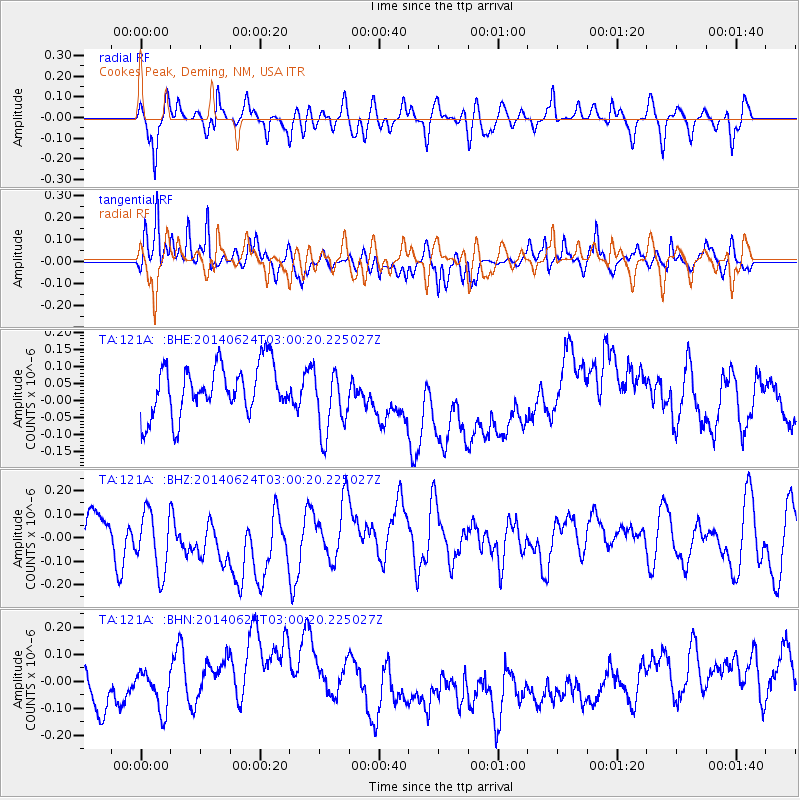
121A Cookes Peak, Deming, NM, USA - Earthquake Result Viewer
*The percent match for this event was below the threshold and hence no stack was calculated.
| Earthquake location: |
Kermadec Islands, New Zealand |
| Earthquake latitude/longitude: |
-30.1/-177.3 |
| Earthquake time(UTC): |
2014/06/24 (175) 02:47:52 GMT |
| Earthquake Depth: |
35 km |
| Earthquake Magnitude: |
5.1 mb |
| Earthquake Catalog/Contributor: |
ISC/ISC |
|
| Network: |
TA USArray Transportable Network (new EarthScope stations) |
| Station: |
121A Cookes Peak, Deming, NM, USA |
| Lat/Lon: |
32.53 N/107.79 W |
| Elevation: |
1652 m |
|
| Distance: |
90.6 deg |
| Az: |
52.323 deg |
| Baz: |
234.328 deg |
| Ray Param: |
$rayparam |
*The percent match for this event was below the threshold and hence was not used in the summary stack. |
|
| Radial Match: |
64.907036 % |
| Radial Bump: |
400 |
| Transverse Match: |
75.25017 % |
| Transverse Bump: |
400 |
| SOD ConfigId: |
3390531 |
| Insert Time: |
2019-04-12 12:17:07.943 +0000 |
| GWidth: |
2.5 |
| Max Bumps: |
400 |
| Tol: |
0.001 |
|
Signal To Noise
| Channel | StoN | STA | LTA |
| TA:121A: :BHZ:20140624T03:00:20.225027Z | 1.5479085 | 1.6477557E-7 | 1.0645046E-7 |
| TA:121A: :BHN:20140624T03:00:20.225027Z | 0.96139354 | 7.811625E-8 | 8.125315E-8 |
| TA:121A: :BHE:20140624T03:00:20.225027Z | 1.3452579 | 9.855556E-8 | 7.326146E-8 |
| Arrivals |
| Ps | |
| PpPs | |
| PsPs/PpSs | |


