You are here: Home > Network List > TA - USArray Transportable Network (new EarthScope stations) Stations List
> Station 256A Glennville, GA, USA > Earthquake Result Viewer
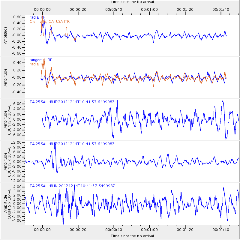
256A Glennville, GA, USA - Earthquake Result Viewer
*The percent match for this event was below the threshold and hence no stack was calculated.
| Earthquake location: |
Off W. Coast Of Baja California |
| Earthquake latitude/longitude: |
31.1/-119.7 |
| Earthquake time(UTC): |
2012/12/14 (349) 10:36:01 GMT |
| Earthquake Depth: |
13 km |
| Earthquake Magnitude: |
6.2 MB, 6.1 MS, 6.3 MW, 6.4 MW |
| Earthquake Catalog/Contributor: |
WHDF/NEIC |
|
| Network: |
TA USArray Transportable Network (new EarthScope stations) |
| Station: |
256A Glennville, GA, USA |
| Lat/Lon: |
31.98 N/81.89 W |
| Elevation: |
46 m |
|
| Distance: |
32.1 deg |
| Az: |
78.393 deg |
| Baz: |
278.587 deg |
| Ray Param: |
$rayparam |
*The percent match for this event was below the threshold and hence was not used in the summary stack. |
|
| Radial Match: |
76.25817 % |
| Radial Bump: |
400 |
| Transverse Match: |
61.67301 % |
| Transverse Bump: |
370 |
| SOD ConfigId: |
491031 |
| Insert Time: |
2013-04-02 15:57:12.460 +0000 |
| GWidth: |
2.5 |
| Max Bumps: |
400 |
| Tol: |
0.001 |
|
Signal To Noise
| Channel | StoN | STA | LTA |
| TA:256A: :BHZ:20121214T10:41:57.649998Z | 2.9720619 | 1.995115E-6 | 6.712899E-7 |
| TA:256A: :BHN:20121214T10:41:57.649998Z | 1.060261 | 1.2549825E-6 | 1.1836543E-6 |
| TA:256A: :BHE:20121214T10:41:57.649998Z | 1.1601325 | 1.5370598E-6 | 1.3249002E-6 |
| Arrivals |
| Ps | |
| PpPs | |
| PsPs/PpSs | |


