You are here: Home > Network List > TA - USArray Transportable Network (new EarthScope stations) Stations List
> Station P53A Whipple, OH, USA > Earthquake Result Viewer
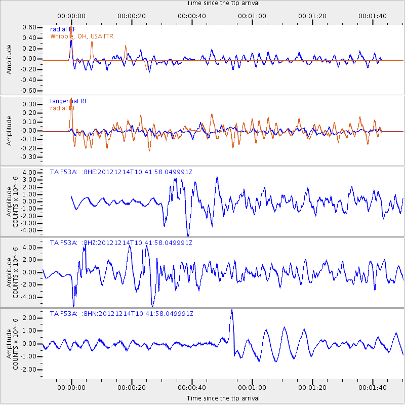
P53A Whipple, OH, USA - Earthquake Result Viewer
*The percent match for this event was below the threshold and hence no stack was calculated.
| Earthquake location: |
Off W. Coast Of Baja California |
| Earthquake latitude/longitude: |
31.1/-119.7 |
| Earthquake time(UTC): |
2012/12/14 (349) 10:36:01 GMT |
| Earthquake Depth: |
13 km |
| Earthquake Magnitude: |
6.2 MB, 6.1 MS, 6.3 MW, 6.4 MW |
| Earthquake Catalog/Contributor: |
WHDF/NEIC |
|
| Network: |
TA USArray Transportable Network (new EarthScope stations) |
| Station: |
P53A Whipple, OH, USA |
| Lat/Lon: |
39.49 N/81.39 W |
| Elevation: |
270 m |
|
| Distance: |
32.1 deg |
| Az: |
64.26 deg |
| Baz: |
266.891 deg |
| Ray Param: |
$rayparam |
*The percent match for this event was below the threshold and hence was not used in the summary stack. |
|
| Radial Match: |
47.63153 % |
| Radial Bump: |
400 |
| Transverse Match: |
53.6443 % |
| Transverse Bump: |
380 |
| SOD ConfigId: |
491031 |
| Insert Time: |
2013-04-02 16:00:26.923 +0000 |
| GWidth: |
2.5 |
| Max Bumps: |
400 |
| Tol: |
0.001 |
|
Signal To Noise
| Channel | StoN | STA | LTA |
| TA:P53A: :BHZ:20121214T10:41:58.049991Z | 4.145684 | 2.6173125E-6 | 6.3133433E-7 |
| TA:P53A: :BHN:20121214T10:41:58.049991Z | 0.8235154 | 2.2118743E-7 | 2.685893E-7 |
| TA:P53A: :BHE:20121214T10:41:58.049991Z | 5.205232 | 1.9006237E-6 | 3.6513717E-7 |
| Arrivals |
| Ps | |
| PpPs | |
| PsPs/PpSs | |


