You are here: Home > Network List > TA - USArray Transportable Network (new EarthScope stations) Stations List
> Station POKR Poker Plat Research Range, AK, USA > Earthquake Result Viewer
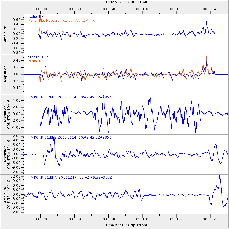
POKR Poker Plat Research Range, AK, USA - Earthquake Result Viewer
*The percent match for this event was below the threshold and hence no stack was calculated.
| Earthquake location: |
Off W. Coast Of Baja California |
| Earthquake latitude/longitude: |
31.1/-119.7 |
| Earthquake time(UTC): |
2012/12/14 (349) 10:36:01 GMT |
| Earthquake Depth: |
13 km |
| Earthquake Magnitude: |
6.2 MB, 6.1 MS, 6.3 MW, 6.4 MW |
| Earthquake Catalog/Contributor: |
WHDF/NEIC |
|
| Network: |
TA USArray Transportable Network (new EarthScope stations) |
| Station: |
POKR Poker Plat Research Range, AK, USA |
| Lat/Lon: |
65.12 N/147.43 W |
| Elevation: |
501 m |
|
| Distance: |
38.1 deg |
| Az: |
341.372 deg |
| Baz: |
139.637 deg |
| Ray Param: |
$rayparam |
*The percent match for this event was below the threshold and hence was not used in the summary stack. |
|
| Radial Match: |
57.45249 % |
| Radial Bump: |
400 |
| Transverse Match: |
55.639774 % |
| Transverse Bump: |
372 |
| SOD ConfigId: |
491031 |
| Insert Time: |
2013-04-02 16:01:11.501 +0000 |
| GWidth: |
2.5 |
| Max Bumps: |
400 |
| Tol: |
0.001 |
|
Signal To Noise
| Channel | StoN | STA | LTA |
| TA:POKR:01:BHZ:20121214T10:42:49.324985Z | 21.771389 | 2.5634731E-6 | 1.1774503E-7 |
| TA:POKR:01:BHN:20121214T10:42:49.324985Z | 1.6883683 | 1.8054524E-6 | 1.0693475E-6 |
| TA:POKR:01:BHE:20121214T10:42:49.324985Z | 1.1794069 | 1.6784159E-6 | 1.4231017E-6 |
| Arrivals |
| Ps | |
| PpPs | |
| PsPs/PpSs | |


