You are here: Home > Network List > GS - US Geological Survey Networks Stations List
> Station DEC12 Boyd Road Surface Site > Earthquake Result Viewer
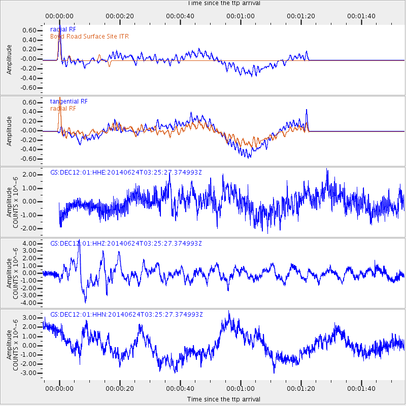
DEC12 Boyd Road Surface Site - Earthquake Result Viewer
*The percent match for this event was below the threshold and hence no stack was calculated.
| Earthquake location: |
Rat Islands, Aleutian Islands |
| Earthquake latitude/longitude: |
52.3/176.7 |
| Earthquake time(UTC): |
2014/06/24 (175) 03:15:36 GMT |
| Earthquake Depth: |
4.0 km |
| Earthquake Magnitude: |
6.3 MWB, 5.7 ML, 6.4 MWC, 6.6 MI |
| Earthquake Catalog/Contributor: |
NEIC PDE/NEIC COMCAT |
|
| Network: |
GS US Geological Survey Networks |
| Station: |
DEC12 Boyd Road Surface Site |
| Lat/Lon: |
39.91 N/88.91 W |
| Elevation: |
208 m |
|
| Distance: |
62.1 deg |
| Az: |
60.206 deg |
| Baz: |
316.087 deg |
| Ray Param: |
$rayparam |
*The percent match for this event was below the threshold and hence was not used in the summary stack. |
|
| Radial Match: |
77.5649 % |
| Radial Bump: |
400 |
| Transverse Match: |
63.52697 % |
| Transverse Bump: |
400 |
| SOD ConfigId: |
3390531 |
| Insert Time: |
2019-04-12 12:21:16.892 +0000 |
| GWidth: |
2.5 |
| Max Bumps: |
400 |
| Tol: |
0.001 |
|
Signal To Noise
| Channel | StoN | STA | LTA |
| GS:DEC12:01:HHZ:20140624T03:25:27.374993Z | 4.2000422 | 1.0510987E-6 | 2.5025906E-7 |
| GS:DEC12:01:HHN:20140624T03:25:27.374993Z | 1.6911489 | 1.6512921E-6 | 9.764321E-7 |
| GS:DEC12:01:HHE:20140624T03:25:27.374993Z | 1.532512 | 7.374697E-7 | 4.8121626E-7 |
| Arrivals |
| Ps | |
| PpPs | |
| PsPs/PpSs | |


