You are here: Home > Network List > TA - USArray Transportable Network (new EarthScope stations) Stations List
> Station S41A Jillco Farms, Salem, MO, USA > Earthquake Result Viewer
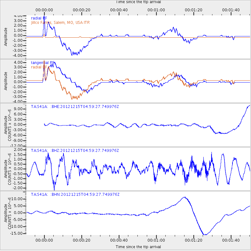
S41A Jillco Farms, Salem, MO, USA - Earthquake Result Viewer
*The percent match for this event was below the threshold and hence no stack was calculated.
| Earthquake location: |
Near Islands, Aleutian Islands |
| Earthquake latitude/longitude: |
52.3/174.0 |
| Earthquake time(UTC): |
2012/12/15 (350) 04:49:29 GMT |
| Earthquake Depth: |
26 km |
| Earthquake Magnitude: |
5.7 MB, 5.7 MS, 6.0 MW, 5.9 MW |
| Earthquake Catalog/Contributor: |
WHDF/NEIC |
|
| Network: |
TA USArray Transportable Network (new EarthScope stations) |
| Station: |
S41A Jillco Farms, Salem, MO, USA |
| Lat/Lon: |
37.59 N/91.75 W |
| Elevation: |
376 m |
|
| Distance: |
63.7 deg |
| Az: |
62.1 deg |
| Baz: |
316.896 deg |
| Ray Param: |
$rayparam |
*The percent match for this event was below the threshold and hence was not used in the summary stack. |
|
| Radial Match: |
23.37089 % |
| Radial Bump: |
400 |
| Transverse Match: |
43.949783 % |
| Transverse Bump: |
400 |
| SOD ConfigId: |
491031 |
| Insert Time: |
2013-04-02 16:16:46.902 +0000 |
| GWidth: |
2.5 |
| Max Bumps: |
400 |
| Tol: |
0.001 |
|
Signal To Noise
| Channel | StoN | STA | LTA |
| TA:S41A: :BHZ:20121215T04:59:27.749976Z | 1.7208375 | 9.379254E-7 | 5.4504005E-7 |
| TA:S41A: :BHN:20121215T04:59:27.749976Z | 1.297172 | 2.6594648E-6 | 2.0502023E-6 |
| TA:S41A: :BHE:20121215T04:59:27.749976Z | 1.6067674 | 7.4248845E-7 | 4.6210076E-7 |
| Arrivals |
| Ps | |
| PpPs | |
| PsPs/PpSs | |


