You are here: Home > Network List > TA - USArray Transportable Network (new EarthScope stations) Stations List
> Station X46A Booneville, MS, USA > Earthquake Result Viewer
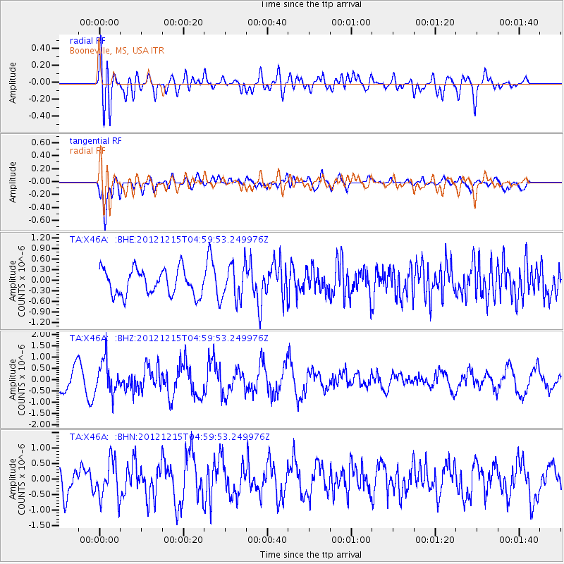
X46A Booneville, MS, USA - Earthquake Result Viewer
*The percent match for this event was below the threshold and hence no stack was calculated.
| Earthquake location: |
Near Islands, Aleutian Islands |
| Earthquake latitude/longitude: |
52.3/174.0 |
| Earthquake time(UTC): |
2012/12/15 (350) 04:49:29 GMT |
| Earthquake Depth: |
26 km |
| Earthquake Magnitude: |
5.7 MB, 5.7 MS, 6.0 MW, 5.9 MW |
| Earthquake Catalog/Contributor: |
WHDF/NEIC |
|
| Network: |
TA USArray Transportable Network (new EarthScope stations) |
| Station: |
X46A Booneville, MS, USA |
| Lat/Lon: |
34.56 N/88.58 W |
| Elevation: |
150 m |
|
| Distance: |
67.7 deg |
| Az: |
62.243 deg |
| Baz: |
318.809 deg |
| Ray Param: |
$rayparam |
*The percent match for this event was below the threshold and hence was not used in the summary stack. |
|
| Radial Match: |
64.23772 % |
| Radial Bump: |
400 |
| Transverse Match: |
77.329575 % |
| Transverse Bump: |
400 |
| SOD ConfigId: |
491031 |
| Insert Time: |
2013-04-02 16:18:09.107 +0000 |
| GWidth: |
2.5 |
| Max Bumps: |
400 |
| Tol: |
0.001 |
|
Signal To Noise
| Channel | StoN | STA | LTA |
| TA:X46A: :BHZ:20121215T04:59:53.249976Z | 1.8009279 | 7.419536E-7 | 4.1198408E-7 |
| TA:X46A: :BHN:20121215T04:59:53.249976Z | 1.6373143 | 6.19846E-7 | 3.785748E-7 |
| TA:X46A: :BHE:20121215T04:59:53.249976Z | 1.3537667 | 4.8763076E-7 | 3.6020293E-7 |
| Arrivals |
| Ps | |
| PpPs | |
| PsPs/PpSs | |


