You are here: Home > Network List > TA - USArray Transportable Network (new EarthScope stations) Stations List
> Station Y53A Monroe, GA, USA > Earthquake Result Viewer
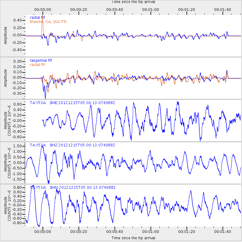
Y53A Monroe, GA, USA - Earthquake Result Viewer
*The percent match for this event was below the threshold and hence no stack was calculated.
| Earthquake location: |
Near Islands, Aleutian Islands |
| Earthquake latitude/longitude: |
52.3/174.0 |
| Earthquake time(UTC): |
2012/12/15 (350) 04:49:29 GMT |
| Earthquake Depth: |
26 km |
| Earthquake Magnitude: |
5.7 MB, 5.7 MS, 6.0 MW, 5.9 MW |
| Earthquake Catalog/Contributor: |
WHDF/NEIC |
|
| Network: |
TA USArray Transportable Network (new EarthScope stations) |
| Station: |
Y53A Monroe, GA, USA |
| Lat/Lon: |
33.86 N/83.58 W |
| Elevation: |
234 m |
|
| Distance: |
70.9 deg |
| Az: |
59.347 deg |
| Baz: |
320.583 deg |
| Ray Param: |
$rayparam |
*The percent match for this event was below the threshold and hence was not used in the summary stack. |
|
| Radial Match: |
43.106327 % |
| Radial Bump: |
400 |
| Transverse Match: |
77.845245 % |
| Transverse Bump: |
400 |
| SOD ConfigId: |
491031 |
| Insert Time: |
2013-04-02 16:19:09.726 +0000 |
| GWidth: |
2.5 |
| Max Bumps: |
400 |
| Tol: |
0.001 |
|
Signal To Noise
| Channel | StoN | STA | LTA |
| TA:Y53A: :BHZ:20121215T05:00:13.074988Z | 3.6220477 | 1.1639424E-6 | 3.213493E-7 |
| TA:Y53A: :BHN:20121215T05:00:13.074988Z | 1.07182 | 4.5394214E-7 | 4.2352457E-7 |
| TA:Y53A: :BHE:20121215T05:00:13.074988Z | 1.4621019 | 2.8108767E-7 | 1.9224902E-7 |
| Arrivals |
| Ps | |
| PpPs | |
| PsPs/PpSs | |


