You are here: Home > Network List > CN - Canadian National Seismograph Network Stations List
> Station INK INUVIK, NT > Earthquake Result Viewer
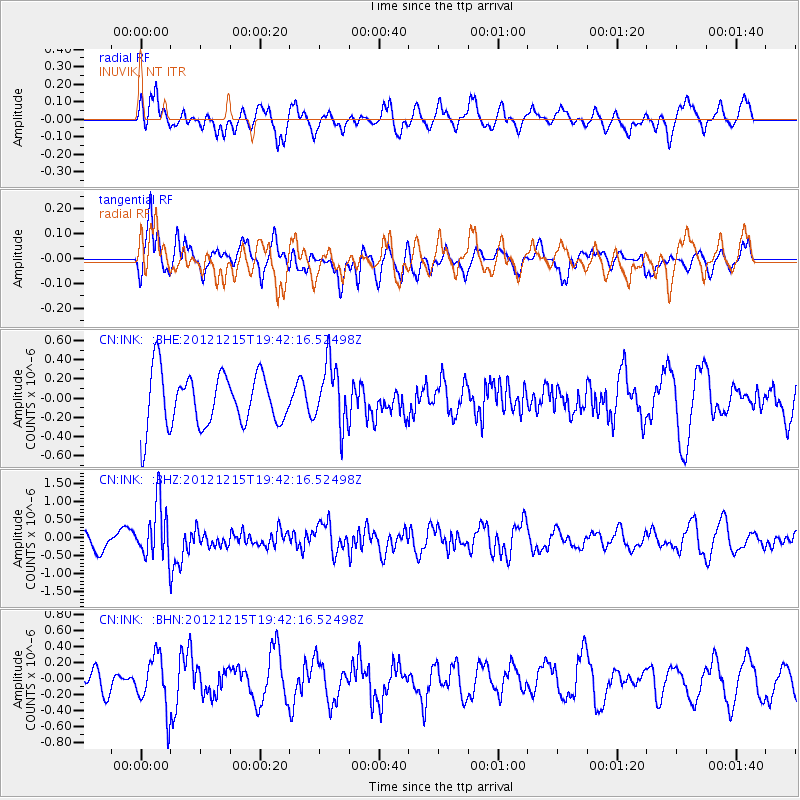
INK INUVIK, NT - Earthquake Result Viewer
*The percent match for this event was below the threshold and hence no stack was calculated.
| Earthquake location: |
New Ireland Region, P.N.G. |
| Earthquake latitude/longitude: |
-4.6/153.0 |
| Earthquake time(UTC): |
2012/12/15 (350) 19:30:02 GMT |
| Earthquake Depth: |
52 km |
| Earthquake Magnitude: |
5.9 MB, 6.1 MW, 6.1 MW |
| Earthquake Catalog/Contributor: |
WHDF/NEIC |
|
| Network: |
CN Canadian National Seismograph Network |
| Station: |
INK INUVIK, NT |
| Lat/Lon: |
68.31 N/133.53 W |
| Elevation: |
44 m |
|
| Distance: |
88.2 deg |
| Az: |
20.89 deg |
| Baz: |
252.938 deg |
| Ray Param: |
$rayparam |
*The percent match for this event was below the threshold and hence was not used in the summary stack. |
|
| Radial Match: |
60.535034 % |
| Radial Bump: |
393 |
| Transverse Match: |
67.319885 % |
| Transverse Bump: |
400 |
| SOD ConfigId: |
491031 |
| Insert Time: |
2013-04-02 16:26:40.713 +0000 |
| GWidth: |
2.5 |
| Max Bumps: |
400 |
| Tol: |
0.001 |
|
Signal To Noise
| Channel | StoN | STA | LTA |
| CN:INK: :BHZ:20121215T19:42:16.52498Z | 2.6663752 | 7.59738E-7 | 2.849329E-7 |
| CN:INK: :BHN:20121215T19:42:16.52498Z | 2.841849 | 3.3549406E-7 | 1.1805485E-7 |
| CN:INK: :BHE:20121215T19:42:16.52498Z | 1.1708518 | 3.2377818E-7 | 2.7653215E-7 |
| Arrivals |
| Ps | |
| PpPs | |
| PsPs/PpSs | |


