You are here: Home > Network List > CN - Canadian National Seismograph Network Stations List
> Station INK INUVIK, NT > Earthquake Result Viewer
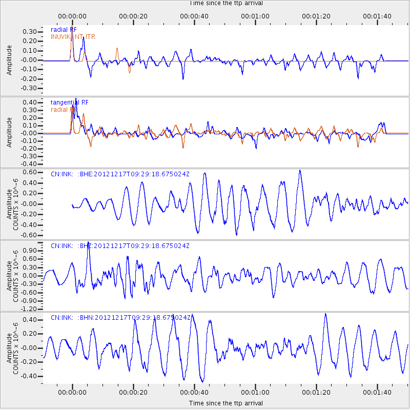
INK INUVIK, NT - Earthquake Result Viewer
*The percent match for this event was below the threshold and hence no stack was calculated.
| Earthquake location: |
Minahassa Peninsula, Sulawesi |
| Earthquake latitude/longitude: |
-0.6/123.8 |
| Earthquake time(UTC): |
2012/12/17 (352) 09:16:30 GMT |
| Earthquake Depth: |
44 km |
| Earthquake Magnitude: |
6.0 MB, 5.6 MS, 6.1 MW, 6.1 MW |
| Earthquake Catalog/Contributor: |
WHDF/NEIC |
|
| Network: |
CN Canadian National Seismograph Network |
| Station: |
INK INUVIK, NT |
| Lat/Lon: |
68.31 N/133.53 W |
| Elevation: |
44 m |
|
| Distance: |
95.3 deg |
| Az: |
21.363 deg |
| Baz: |
281.55 deg |
| Ray Param: |
$rayparam |
*The percent match for this event was below the threshold and hence was not used in the summary stack. |
|
| Radial Match: |
58.505905 % |
| Radial Bump: |
357 |
| Transverse Match: |
59.370827 % |
| Transverse Bump: |
400 |
| SOD ConfigId: |
491031 |
| Insert Time: |
2013-04-05 11:17:06.308 +0000 |
| GWidth: |
2.5 |
| Max Bumps: |
400 |
| Tol: |
0.001 |
|
Signal To Noise
| Channel | StoN | STA | LTA |
| CN:INK: :BHZ:20121217T09:29:18.675024Z | 1.6237035 | 3.4425577E-7 | 2.1201886E-7 |
| CN:INK: :BHN:20121217T09:29:18.675024Z | 0.5260796 | 1.0176483E-7 | 1.9343999E-7 |
| CN:INK: :BHE:20121217T09:29:18.675024Z | 0.7008964 | 1.2696486E-7 | 1.8114642E-7 |
| Arrivals |
| Ps | |
| PpPs | |
| PsPs/PpSs | |


