You are here: Home > Network List > TA - USArray Transportable Network (new EarthScope stations) Stations List
> Station POKR Poker Plat Research Range, AK, USA > Earthquake Result Viewer
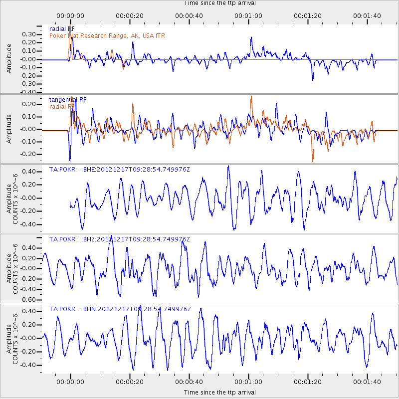
POKR Poker Plat Research Range, AK, USA - Earthquake Result Viewer
*The percent match for this event was below the threshold and hence no stack was calculated.
| Earthquake location: |
Minahassa Peninsula, Sulawesi |
| Earthquake latitude/longitude: |
-0.6/123.8 |
| Earthquake time(UTC): |
2012/12/17 (352) 09:16:30 GMT |
| Earthquake Depth: |
44 km |
| Earthquake Magnitude: |
6.0 MB, 5.6 MS, 6.1 MW, 6.1 MW |
| Earthquake Catalog/Contributor: |
WHDF/NEIC |
|
| Network: |
TA USArray Transportable Network (new EarthScope stations) |
| Station: |
POKR Poker Plat Research Range, AK, USA |
| Lat/Lon: |
65.12 N/147.43 W |
| Elevation: |
501 m |
|
| Distance: |
90.1 deg |
| Az: |
25.024 deg |
| Baz: |
268.603 deg |
| Ray Param: |
$rayparam |
*The percent match for this event was below the threshold and hence was not used in the summary stack. |
|
| Radial Match: |
46.253735 % |
| Radial Bump: |
400 |
| Transverse Match: |
49.385532 % |
| Transverse Bump: |
400 |
| SOD ConfigId: |
491031 |
| Insert Time: |
2013-04-05 11:18:44.429 +0000 |
| GWidth: |
2.5 |
| Max Bumps: |
400 |
| Tol: |
0.001 |
|
Signal To Noise
| Channel | StoN | STA | LTA |
| TA:POKR: :BHZ:20121217T09:28:54.749976Z | 1.0402037 | 1.9745656E-7 | 1.898249E-7 |
| TA:POKR: :BHN:20121217T09:28:54.749976Z | 0.985974 | 1.4060655E-7 | 1.4260675E-7 |
| TA:POKR: :BHE:20121217T09:28:54.749976Z | 0.82809323 | 1.4412309E-7 | 1.7404211E-7 |
| Arrivals |
| Ps | |
| PpPs | |
| PsPs/PpSs | |


