You are here: Home > Network List > CN - Canadian National Seismograph Network Stations List
> Station INK INUVIK, NT > Earthquake Result Viewer
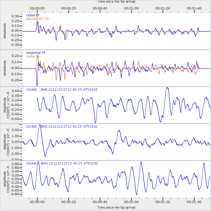
INK INUVIK, NT - Earthquake Result Viewer
*The percent match for this event was below the threshold and hence no stack was calculated.
| Earthquake location: |
Vanuatu Islands |
| Earthquake latitude/longitude: |
-14.3/167.3 |
| Earthquake time(UTC): |
2012/12/21 (356) 22:28:08 GMT |
| Earthquake Depth: |
201 km |
| Earthquake Magnitude: |
6.1 MB, 6.7 MW, 6.7 MW |
| Earthquake Catalog/Contributor: |
WHDF/NEIC |
|
| Network: |
CN Canadian National Seismograph Network |
| Station: |
INK INUVIK, NT |
| Lat/Lon: |
68.31 N/133.53 W |
| Elevation: |
44 m |
|
| Distance: |
92.5 deg |
| Az: |
18.64 deg |
| Baz: |
236.432 deg |
| Ray Param: |
$rayparam |
*The percent match for this event was below the threshold and hence was not used in the summary stack. |
|
| Radial Match: |
71.75779 % |
| Radial Bump: |
400 |
| Transverse Match: |
70.95895 % |
| Transverse Bump: |
400 |
| SOD ConfigId: |
491031 |
| Insert Time: |
2013-04-05 11:34:34.342 +0000 |
| GWidth: |
2.5 |
| Max Bumps: |
400 |
| Tol: |
0.001 |
|
Signal To Noise
| Channel | StoN | STA | LTA |
| CN:INK: :BHZ:20121221T22:40:25.475029Z | 8.390781 | 1.7163838E-6 | 2.045559E-7 |
| CN:INK: :BHN:20121221T22:40:25.475029Z | 2.4776332 | 5.112817E-7 | 2.063589E-7 |
| CN:INK: :BHE:20121221T22:40:25.475029Z | 1.0657885 | 2.490702E-7 | 2.3369573E-7 |
| Arrivals |
| Ps | |
| PpPs | |
| PsPs/PpSs | |


