You are here: Home > Network List > TA - USArray Transportable Network (new EarthScope stations) Stations List
> Station Q24A Divide, CO, USA > Earthquake Result Viewer
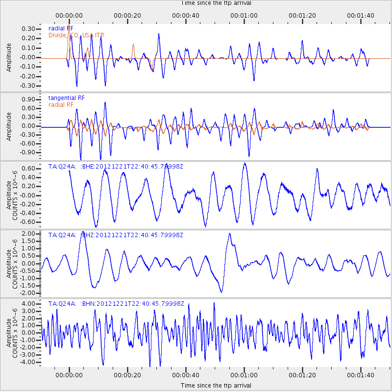
Q24A Divide, CO, USA - Earthquake Result Viewer
*The percent match for this event was below the threshold and hence no stack was calculated.
| Earthquake location: |
Vanuatu Islands |
| Earthquake latitude/longitude: |
-14.3/167.3 |
| Earthquake time(UTC): |
2012/12/21 (356) 22:28:08 GMT |
| Earthquake Depth: |
201 km |
| Earthquake Magnitude: |
6.1 MB, 6.7 MW, 6.7 MW |
| Earthquake Catalog/Contributor: |
WHDF/NEIC |
|
| Network: |
TA USArray Transportable Network (new EarthScope stations) |
| Station: |
Q24A Divide, CO, USA |
| Lat/Lon: |
38.96 N/105.15 W |
| Elevation: |
2775 m |
|
| Distance: |
97.0 deg |
| Az: |
51.699 deg |
| Baz: |
257.329 deg |
| Ray Param: |
$rayparam |
*The percent match for this event was below the threshold and hence was not used in the summary stack. |
|
| Radial Match: |
45.38865 % |
| Radial Bump: |
400 |
| Transverse Match: |
44.092342 % |
| Transverse Bump: |
400 |
| SOD ConfigId: |
491031 |
| Insert Time: |
2013-04-05 11:38:15.272 +0000 |
| GWidth: |
2.5 |
| Max Bumps: |
400 |
| Tol: |
0.001 |
|
Signal To Noise
| Channel | StoN | STA | LTA |
| TA:Q24A: :BHZ:20121221T22:40:45.79998Z | 2.9193282 | 1.0357649E-6 | 3.5479562E-7 |
| TA:Q24A: :BHN:20121221T22:40:45.79998Z | 0.5886811 | 1.0009583E-6 | 1.7003405E-6 |
| TA:Q24A: :BHE:20121221T22:40:45.79998Z | 1.3498601 | 4.6728394E-7 | 3.4617213E-7 |
| Arrivals |
| Ps | |
| PpPs | |
| PsPs/PpSs | |


