You are here: Home > Network List > G - GEOSCOPE Stations List
> Station ATD Arta Cave - Arta, Republic of Djibouti > Earthquake Result Viewer
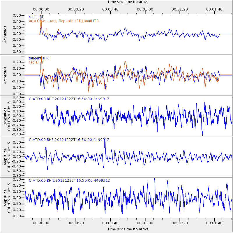
ATD Arta Cave - Arta, Republic of Djibouti - Earthquake Result Viewer
*The percent match for this event was below the threshold and hence no stack was calculated.
| Earthquake location: |
Myanmar |
| Earthquake latitude/longitude: |
22.4/94.8 |
| Earthquake time(UTC): |
2012/12/22 (357) 16:41:45 GMT |
| Earthquake Depth: |
134 km |
| Earthquake Magnitude: |
5.5 MW, 5.4 MB, 5.5 MW |
| Earthquake Catalog/Contributor: |
WHDF/NEIC |
|
| Network: |
G GEOSCOPE |
| Station: |
ATD Arta Cave - Arta, Republic of Djibouti |
| Lat/Lon: |
11.53 N/42.85 E |
| Elevation: |
610 m |
|
| Distance: |
50.6 deg |
| Az: |
266.616 deg |
| Baz: |
70.445 deg |
| Ray Param: |
$rayparam |
*The percent match for this event was below the threshold and hence was not used in the summary stack. |
|
| Radial Match: |
53.877674 % |
| Radial Bump: |
400 |
| Transverse Match: |
63.367714 % |
| Transverse Bump: |
400 |
| SOD ConfigId: |
491031 |
| Insert Time: |
2013-04-05 11:46:49.742 +0000 |
| GWidth: |
2.5 |
| Max Bumps: |
400 |
| Tol: |
0.001 |
|
Signal To Noise
| Channel | StoN | STA | LTA |
| G:ATD:00:BHZ:20121222T16:50:00.449991Z | 2.69939 | 2.0059488E-7 | 7.4311195E-8 |
| G:ATD:00:BHN:20121222T16:50:00.449991Z | 1.1700975 | 8.259582E-8 | 7.058884E-8 |
| G:ATD:00:BHE:20121222T16:50:00.449991Z | 1.5608678 | 1.3951714E-7 | 8.938434E-8 |
| Arrivals |
| Ps | |
| PpPs | |
| PsPs/PpSs | |


