You are here: Home > Network List > TA - USArray Transportable Network (new EarthScope stations) Stations List
> Station N46A Monticello, IN, USA > Earthquake Result Viewer
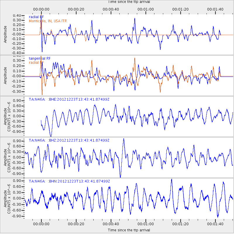
N46A Monticello, IN, USA - Earthquake Result Viewer
*The percent match for this event was below the threshold and hence no stack was calculated.
| Earthquake location: |
Northwestern Caucasus |
| Earthquake latitude/longitude: |
42.4/41.1 |
| Earthquake time(UTC): |
2012/12/23 (358) 13:31:40 GMT |
| Earthquake Depth: |
15 km |
| Earthquake Magnitude: |
5.5 MB, 5.6 MS, 5.7 MW, 5.6 MW |
| Earthquake Catalog/Contributor: |
WHDF/NEIC |
|
| Network: |
TA USArray Transportable Network (new EarthScope stations) |
| Station: |
N46A Monticello, IN, USA |
| Lat/Lon: |
40.89 N/86.74 W |
| Elevation: |
209 m |
|
| Distance: |
84.6 deg |
| Az: |
323.016 deg |
| Baz: |
35.988 deg |
| Ray Param: |
$rayparam |
*The percent match for this event was below the threshold and hence was not used in the summary stack. |
|
| Radial Match: |
57.890163 % |
| Radial Bump: |
400 |
| Transverse Match: |
53.777843 % |
| Transverse Bump: |
400 |
| SOD ConfigId: |
491031 |
| Insert Time: |
2013-04-10 03:49:50.411 +0000 |
| GWidth: |
2.5 |
| Max Bumps: |
400 |
| Tol: |
0.001 |
|
Signal To Noise
| Channel | StoN | STA | LTA |
| TA:N46A: :BHZ:20121223T13:43:41.87499Z | 1.6159536 | 4.499307E-7 | 2.7843046E-7 |
| TA:N46A: :BHN:20121223T13:43:41.87499Z | 0.9237742 | 2.6096257E-7 | 2.8249605E-7 |
| TA:N46A: :BHE:20121223T13:43:41.87499Z | 1.2189612 | 4.6164007E-7 | 3.7871595E-7 |
| Arrivals |
| Ps | |
| PpPs | |
| PsPs/PpSs | |


