You are here: Home > Network List > IW - Intermountain West Stations List
> Station DLMT Dillon, Montana, USA > Earthquake Result Viewer
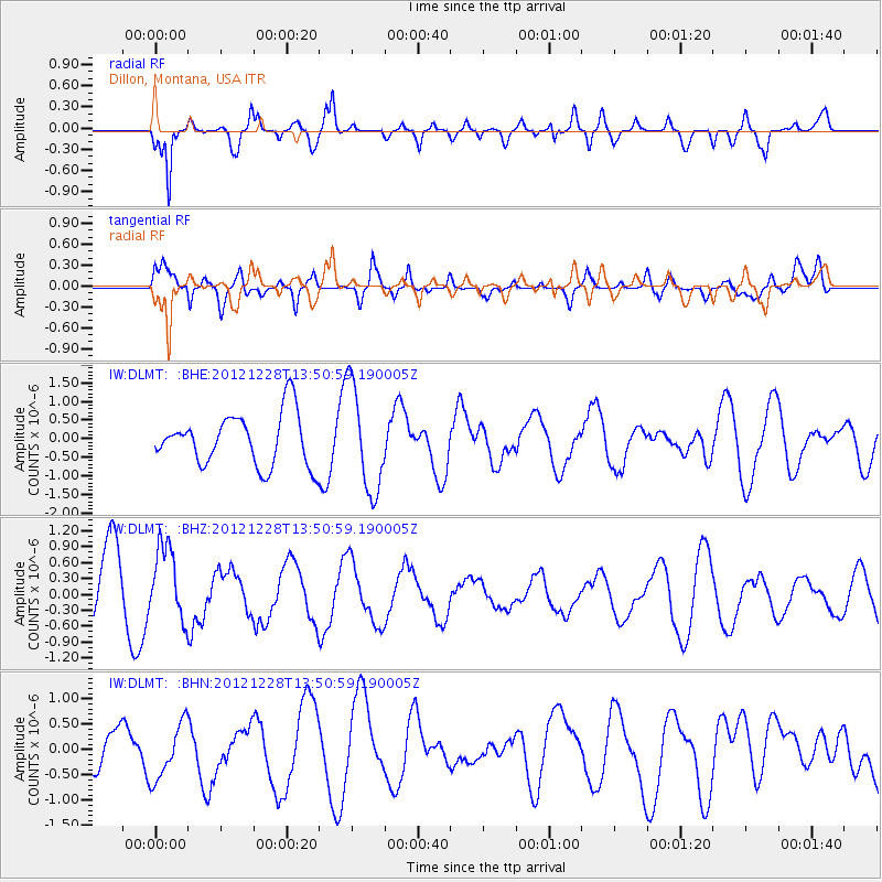
DLMT Dillon, Montana, USA - Earthquake Result Viewer
*The percent match for this event was below the threshold and hence no stack was calculated.
| Earthquake location: |
Komandorskiye Ostrova Region |
| Earthquake latitude/longitude: |
55.7/164.7 |
| Earthquake time(UTC): |
2012/12/28 (363) 13:42:34 GMT |
| Earthquake Depth: |
35 km |
| Earthquake Magnitude: |
5.5 MB, 5.1 MW |
| Earthquake Catalog/Contributor: |
WHDF/NEIC |
|
| Network: |
IW Intermountain West |
| Station: |
DLMT Dillon, Montana, USA |
| Lat/Lon: |
45.36 N/112.60 W |
| Elevation: |
1569 m |
|
| Distance: |
50.5 deg |
| Az: |
64.913 deg |
| Baz: |
313.355 deg |
| Ray Param: |
$rayparam |
*The percent match for this event was below the threshold and hence was not used in the summary stack. |
|
| Radial Match: |
87.55484 % |
| Radial Bump: |
400 |
| Transverse Match: |
62.760464 % |
| Transverse Bump: |
400 |
| SOD ConfigId: |
491031 |
| Insert Time: |
2013-04-10 04:13:30.484 +0000 |
| GWidth: |
2.5 |
| Max Bumps: |
400 |
| Tol: |
0.001 |
|
Signal To Noise
| Channel | StoN | STA | LTA |
| IW:DLMT: :BHZ:20121228T13:50:59.190005Z | 1.1646914 | 6.92333E-7 | 5.944347E-7 |
| IW:DLMT: :BHN:20121228T13:50:59.190005Z | 1.1337283 | 5.498254E-7 | 4.8497105E-7 |
| IW:DLMT: :BHE:20121228T13:50:59.190005Z | 2.0311272 | 1.4123223E-6 | 6.9533917E-7 |
| Arrivals |
| Ps | |
| PpPs | |
| PsPs/PpSs | |


