You are here: Home > Network List > TA - USArray Transportable Network (new EarthScope stations) Stations List
> Station E43A Lone Tree Farm, Eben Junction, MI, USA > Earthquake Result Viewer
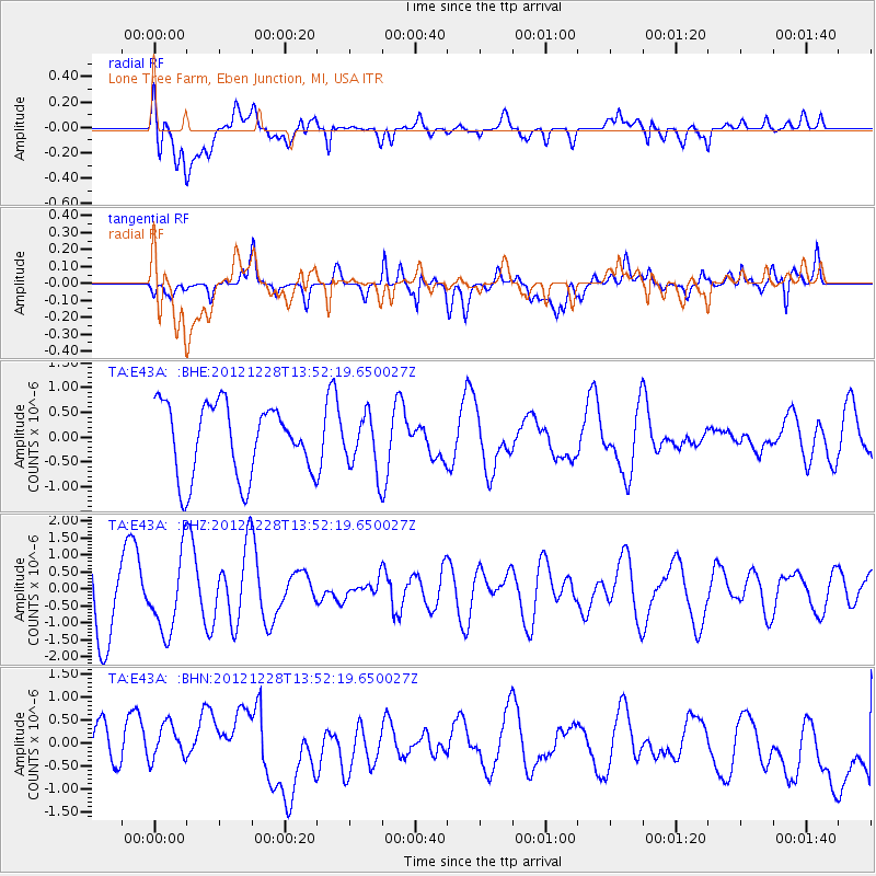
E43A Lone Tree Farm, Eben Junction, MI, USA - Earthquake Result Viewer
*The percent match for this event was below the threshold and hence no stack was calculated.
| Earthquake location: |
Komandorskiye Ostrova Region |
| Earthquake latitude/longitude: |
55.7/164.7 |
| Earthquake time(UTC): |
2012/12/28 (363) 13:42:34 GMT |
| Earthquake Depth: |
35 km |
| Earthquake Magnitude: |
5.5 MB, 5.1 MW |
| Earthquake Catalog/Contributor: |
WHDF/NEIC |
|
| Network: |
TA USArray Transportable Network (new EarthScope stations) |
| Station: |
E43A Lone Tree Farm, Eben Junction, MI, USA |
| Lat/Lon: |
46.38 N/87.00 W |
| Elevation: |
303 m |
|
| Distance: |
61.8 deg |
| Az: |
48.217 deg |
| Baz: |
322.439 deg |
| Ray Param: |
$rayparam |
*The percent match for this event was below the threshold and hence was not used in the summary stack. |
|
| Radial Match: |
46.51818 % |
| Radial Bump: |
400 |
| Transverse Match: |
54.253075 % |
| Transverse Bump: |
400 |
| SOD ConfigId: |
491031 |
| Insert Time: |
2013-04-10 04:17:40.706 +0000 |
| GWidth: |
2.5 |
| Max Bumps: |
400 |
| Tol: |
0.001 |
|
Signal To Noise
| Channel | StoN | STA | LTA |
| TA:E43A: :BHZ:20121228T13:52:19.650027Z | 0.9004465 | 1.1095879E-6 | 1.2322641E-6 |
| TA:E43A: :BHN:20121228T13:52:19.650027Z | 0.6448545 | 4.6082405E-7 | 7.146171E-7 |
| TA:E43A: :BHE:20121228T13:52:19.650027Z | 0.7706822 | 5.5757323E-7 | 7.2348007E-7 |
| Arrivals |
| Ps | |
| PpPs | |
| PsPs/PpSs | |


