You are here: Home > Network List > CI - Caltech Regional Seismic Network Stations List
> Station SMM Simmler, CA, USA > Earthquake Result Viewer
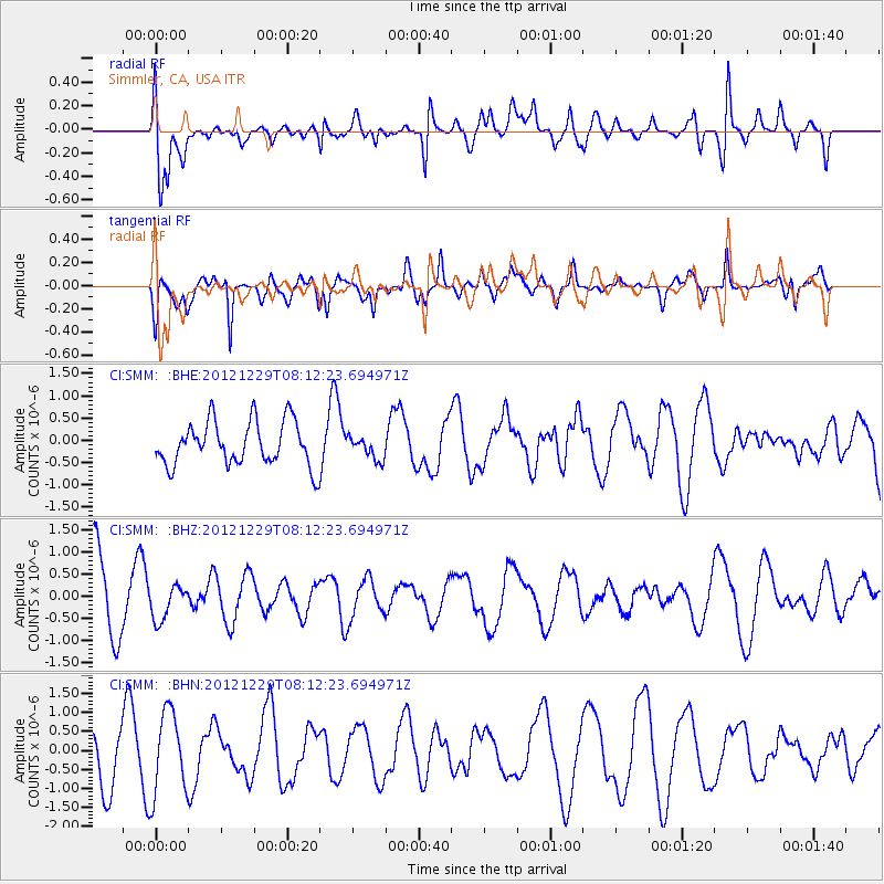
SMM Simmler, CA, USA - Earthquake Result Viewer
*The percent match for this event was below the threshold and hence no stack was calculated.
| Earthquake location: |
Bismarck Sea |
| Earthquake latitude/longitude: |
-3.6/148.9 |
| Earthquake time(UTC): |
2012/12/29 (364) 07:59:41 GMT |
| Earthquake Depth: |
4.0 km |
| Earthquake Magnitude: |
5.7 MS, 5.4 MB, 5.7 MW, 6.0 MW |
| Earthquake Catalog/Contributor: |
WHDF/NEIC |
|
| Network: |
CI Caltech Regional Seismic Network |
| Station: |
SMM Simmler, CA, USA |
| Lat/Lon: |
35.31 N/120.00 W |
| Elevation: |
599 m |
|
| Distance: |
92.9 deg |
| Az: |
54.959 deg |
| Baz: |
267.739 deg |
| Ray Param: |
$rayparam |
*The percent match for this event was below the threshold and hence was not used in the summary stack. |
|
| Radial Match: |
59.443607 % |
| Radial Bump: |
400 |
| Transverse Match: |
63.81733 % |
| Transverse Bump: |
400 |
| SOD ConfigId: |
491031 |
| Insert Time: |
2013-04-10 04:28:09.688 +0000 |
| GWidth: |
2.5 |
| Max Bumps: |
400 |
| Tol: |
0.001 |
|
Signal To Noise
| Channel | StoN | STA | LTA |
| CI:SMM: :BHZ:20121229T08:12:23.694971Z | 0.5959422 | 3.8404684E-7 | 6.444364E-7 |
| CI:SMM: :BHN:20121229T08:12:23.694971Z | 1.958945 | 1.0807672E-6 | 5.517088E-7 |
| CI:SMM: :BHE:20121229T08:12:23.694971Z | 0.52458364 | 2.5811258E-7 | 4.920332E-7 |
| Arrivals |
| Ps | |
| PpPs | |
| PsPs/PpSs | |


