You are here: Home > Network List > G - GEOSCOPE Stations List
> Station CLF Chambon la Foret observatory, France > Earthquake Result Viewer
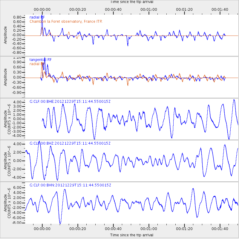
CLF Chambon la Foret observatory, France - Earthquake Result Viewer
*The percent match for this event was below the threshold and hence no stack was calculated.
| Earthquake location: |
Near East Coast Of Honshu, Japan |
| Earthquake latitude/longitude: |
38.7/142.0 |
| Earthquake time(UTC): |
2012/12/29 (364) 14:59:38 GMT |
| Earthquake Depth: |
56 km |
| Earthquake Magnitude: |
5.5 MW, 5.4 MW, 5.4 MB |
| Earthquake Catalog/Contributor: |
WHDF/NEIC |
|
| Network: |
G GEOSCOPE |
| Station: |
CLF Chambon la Foret observatory, France |
| Lat/Lon: |
48.03 N/2.26 E |
| Elevation: |
145 m |
|
| Distance: |
86.5 deg |
| Az: |
334.252 deg |
| Baz: |
30.405 deg |
| Ray Param: |
$rayparam |
*The percent match for this event was below the threshold and hence was not used in the summary stack. |
|
| Radial Match: |
43.840847 % |
| Radial Bump: |
400 |
| Transverse Match: |
85.07829 % |
| Transverse Bump: |
400 |
| SOD ConfigId: |
491031 |
| Insert Time: |
2013-04-10 04:35:42.893 +0000 |
| GWidth: |
2.5 |
| Max Bumps: |
400 |
| Tol: |
0.001 |
|
Signal To Noise
| Channel | StoN | STA | LTA |
| G:CLF:00:BHZ:20121229T15:11:44.550015Z | 1.6448094 | 2.702217E-6 | 1.6428755E-6 |
| G:CLF:00:BHN:20121229T15:11:44.550015Z | 0.96777755 | 2.269845E-6 | 2.3454202E-6 |
| G:CLF:00:BHE:20121229T15:11:44.550015Z | 1.2790353 | 2.4974854E-6 | 1.9526321E-6 |
| Arrivals |
| Ps | |
| PpPs | |
| PsPs/PpSs | |


