You are here: Home > Network List > TA - USArray Transportable Network (new EarthScope stations) Stations List
> Station X43A Marvell, AR, USA > Earthquake Result Viewer
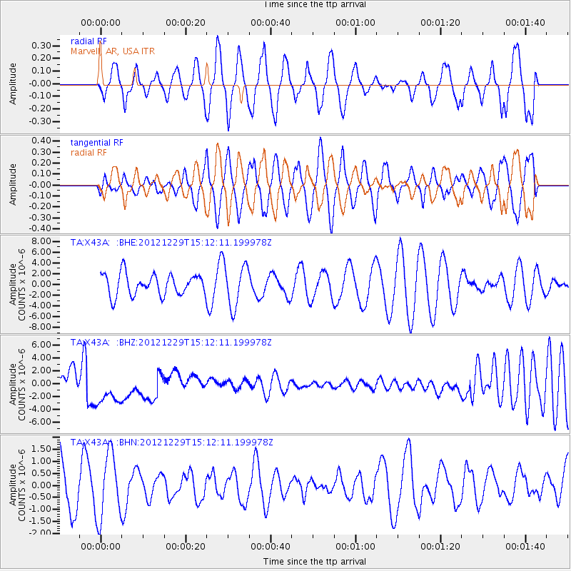
X43A Marvell, AR, USA - Earthquake Result Viewer
*The percent match for this event was below the threshold and hence no stack was calculated.
| Earthquake location: |
Near East Coast Of Honshu, Japan |
| Earthquake latitude/longitude: |
38.7/142.0 |
| Earthquake time(UTC): |
2012/12/29 (364) 14:59:38 GMT |
| Earthquake Depth: |
56 km |
| Earthquake Magnitude: |
5.5 MW, 5.4 MW, 5.4 MB |
| Earthquake Catalog/Contributor: |
WHDF/NEIC |
|
| Network: |
TA USArray Transportable Network (new EarthScope stations) |
| Station: |
X43A Marvell, AR, USA |
| Lat/Lon: |
34.52 N/90.88 W |
| Elevation: |
53 m |
|
| Distance: |
92.2 deg |
| Az: |
41.231 deg |
| Baz: |
321.373 deg |
| Ray Param: |
$rayparam |
*The percent match for this event was below the threshold and hence was not used in the summary stack. |
|
| Radial Match: |
38.826675 % |
| Radial Bump: |
400 |
| Transverse Match: |
41.941933 % |
| Transverse Bump: |
400 |
| SOD ConfigId: |
491031 |
| Insert Time: |
2013-04-10 04:39:42.669 +0000 |
| GWidth: |
2.5 |
| Max Bumps: |
400 |
| Tol: |
0.001 |
|
Signal To Noise
| Channel | StoN | STA | LTA |
| TA:X43A: :BHZ:20121229T15:12:11.199978Z | 1.3490734 | 3.208484E-6 | 2.3782873E-6 |
| TA:X43A: :BHN:20121229T15:12:11.199978Z | 1.3690594 | 1.3726745E-6 | 1.0026405E-6 |
| TA:X43A: :BHE:20121229T15:12:11.199978Z | 1.9688802 | 3.8925145E-6 | 1.9770193E-6 |
| Arrivals |
| Ps | |
| PpPs | |
| PsPs/PpSs | |


