You are here: Home > Network List > TA - USArray Transportable Network (new EarthScope stations) Stations List
> Station P42A Winchester, IL, USA > Earthquake Result Viewer
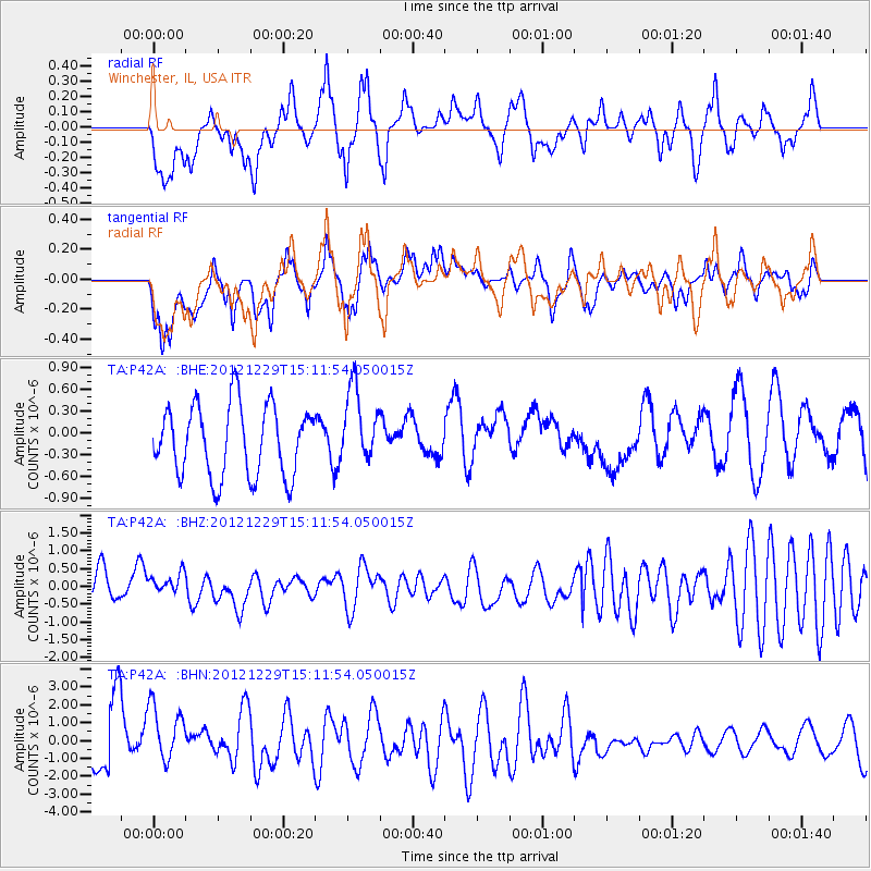
P42A Winchester, IL, USA - Earthquake Result Viewer
*The percent match for this event was below the threshold and hence no stack was calculated.
| Earthquake location: |
Near East Coast Of Honshu, Japan |
| Earthquake latitude/longitude: |
38.7/142.0 |
| Earthquake time(UTC): |
2012/12/29 (364) 14:59:38 GMT |
| Earthquake Depth: |
56 km |
| Earthquake Magnitude: |
5.5 MW, 5.4 MW, 5.4 MB |
| Earthquake Catalog/Contributor: |
WHDF/NEIC |
|
| Network: |
TA USArray Transportable Network (new EarthScope stations) |
| Station: |
P42A Winchester, IL, USA |
| Lat/Lon: |
39.59 N/90.34 W |
| Elevation: |
197 m |
|
| Distance: |
88.5 deg |
| Az: |
37.75 deg |
| Baz: |
321.715 deg |
| Ray Param: |
$rayparam |
*The percent match for this event was below the threshold and hence was not used in the summary stack. |
|
| Radial Match: |
53.650314 % |
| Radial Bump: |
392 |
| Transverse Match: |
50.7017 % |
| Transverse Bump: |
400 |
| SOD ConfigId: |
491031 |
| Insert Time: |
2013-04-10 04:40:05.756 +0000 |
| GWidth: |
2.5 |
| Max Bumps: |
400 |
| Tol: |
0.001 |
|
Signal To Noise
| Channel | StoN | STA | LTA |
| TA:P42A: :BHZ:20121229T15:11:54.050015Z | 0.6332873 | 3.8003174E-7 | 6.000937E-7 |
| TA:P42A: :BHN:20121229T15:11:54.050015Z | 1.4064859 | 1.8938903E-6 | 1.3465404E-6 |
| TA:P42A: :BHE:20121229T15:11:54.050015Z | 1.0678463 | 5.174606E-7 | 4.8458344E-7 |
| Arrivals |
| Ps | |
| PpPs | |
| PsPs/PpSs | |


